place

St Clement, Cornwall

Civil parishes in CornwallManors in CornwallVillages in Cornwall
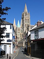
St Clement from Truro road

St Clement (Cornish: Klemens) is a civil parish and village in Cornwall, England, United Kingdom. It is situated southeast of Truro in the valley of the Tresillian River. Other notable villages within the parish are the much larger Tresillian 1.4 miles (2.3 km) to the north east of St Clement village itself and another village at Malpas to the south of the parish. The urban part of the parish of St Clement was incorporated into Truro in 1895. The remainder of the parish had a population of 1,064 at the 2011 census.From 2009 to 2021, St Clement was covered by the Ladock, St Clement and St Erme division. From the 2021 local elections, it will be within the Truro Tregolls division. St Clement is attractive for tourists: aside from the natural beauty of the surrounding countryside they come to see the village church and its associated conservation projects that are maintained by members of the local community. Unlike some other villages in the district, the village of St Clement has changed very little in recent times.The parish of St Clement lies within the Cornwall Area of Outstanding Natural Beauty (AONB). The Tresillian River includes many scenic paths leading to a walkway owned by the Duchy of Cornwall.

Excerpt from the Wikipedia article St Clement, Cornwall (License: CC BY-SA 3.0, Authors, Images).

St Clement, Cornwall
Denas Road,

Geographical coordinates (GPS) Address Nearby Places
placeShow on map

Wikipedia: St Clement, CornwallContinue reading on Wikipedia

Geographical coordinates (GPS)

Latitude Longitude
N 50.255 ° E -5.018 °
placeShow on map

Address

Denas Road
TR1 1SZ
England, United Kingdom
mapOpen on Google Maps

St Clement from Truro road
Share experience

Nearby Places

Truro River
Truro River

The Truro River (Cornish: Hyldreth) is a river in the city of Truro in Cornwall, England, UK. It is the product of the convergence of the two rivers named Kenwyn and Allen which run under the city: the Truro River (named after the city) flows into the River Fal, estuarial waters where wildlife is abundant, and then out into the Carrick Roads. The river is navigable up to Truro. The river valleys form a bowl surrounding the city on the north, east and west and open to the Truro River in the south. The fairly steep-sided bowl in which Truro is located, along with high precipitation swelling the rivers and a spring tide in the River Fal, were major causes of flooding in 1988 which caused large amounts of damage to the city centre. Since then, flood defences have been constructed around the city, including an emergency dam at New Mill on the River Kenwyn and a tidal barrier on the Truro River, to prevent future problems. The valley of the Tresillian River is between the valleys of the Truro River and the Fal; the Tresillian River flows into the Truro River just upstream of where the latter joins the Fal. Early records give the Tresillian River the name "Seugar" (1297) or "Sowgar" (1530); the meaning of this name is unknown.The river is mentioned in the medieval Cornish language play Bewnans Ke (c. 1550), as the place from which the eponymous Saint Kea embarks for Rosené. It uses the river's Cornish name Hildrech, which in modern spelling is Hyldreth.