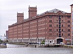
Merseyside ( MUR-zee-syde) is a metropolitan and ceremonial county in North West England, with a population of 1.38 million. It encompasses both banks of the Mersey Estuary and comprises five metropolitan boroughs: Knowsley, St Helens, Sefton, Wirral and the city of Liverpool. Merseyside, which was created on 1 April 1974 as a result of the Local Government Act 1972, takes its name from the River Mersey and sits within the historic counties of Lancashire and Cheshire.
Merseyside spans 249 square miles (645 km2) of land. It borders the ceremonial counties of Lancashire (to the north-east), Greater Manchester (to the east), Cheshire (to the south and south-east) and the Irish Sea to the west. North Wales is across the Dee Estuary. There is a mix of high density urban areas, suburbs, semi-rural and rural locations in Merseyside, but overwhelmingly the land use is urban. It has a focused central business district, formed by Liverpool City Centre, but Merseyside is also a polycentric county with five metropolitan districts, each of which has at least one major town centre and outlying suburbs. The Liverpool Urban Area is the fifth most populous conurbation in England and dominates the geographic centre of the county, while the Birkenhead Urban Area dominates the Wirral Peninsula in the south.
In the 12 years following 1974, the county had a two-tier system of local government; district councils shared power with the Merseyside County Council. The county council was abolished in 1986 and so its districts (the metropolitan boroughs) are now effectively unitary authority areas. However, the metropolitan county continues to exist in law and as a geographic frame of reference, and several county-wide services are co-ordinated by authorities and joint-boards, such as Merseytravel (for public transport), Merseyside Fire and Rescue Service and the Merseyside Police (for law-enforcement); as a ceremonial county, Merseyside has a Lord Lieutenant and a High Sheriff. As the Lancashire county palatine boundaries remain the same as the historic boundaries, the High Sheriff of Merseyside, along with those of Lancashire and Greater Manchester are appointed "within the Duchy and County Palatine of Lancaster".The boroughs of Merseyside are joined by the neighbouring borough of Halton in Cheshire to form the Liverpool City Region, which is a local enterprise partnership and combined authority area.
Merseyside is an amalgamation of 22 former local government districts from the former administrative counties of Lancashire, Cheshire and six autonomous county boroughs centred on Birkenhead, Bootle, Liverpool, Southport, St Helens and Wallasey.


