place

Springfield Cemetery (Springfield, Massachusetts)

1841 establishments in Massachusetts19th century in Springfield, MassachusettsBuildings and structures in Springfield, MassachusettsCemeteries established in the 1840sCemeteries in Hampden County, Massachusetts
Rural cemeteries
Springfield Cemetery (2375991456)

Springfield Cemetery is located in the Connecticut River Valley city of Springfield, Massachusetts. The cemetery opened in 1841 and was planned on the model of a rural cemetery. With the relocation of remains from the city's earliest burying ground, the cemetery became the final resting place for many of Springfield's 17th and 18th century pioneer settlers.

Excerpt from the Wikipedia article Springfield Cemetery (Springfield, Massachusetts) (License: CC BY-SA 3.0, Authors, Images).

Springfield Cemetery (Springfield, Massachusetts)
Mulberry Street, Springfield

Geographical coordinates (GPS) Address Nearby Places
placeShow on map

Wikipedia: Springfield Cemetery (Springfield, Massachusetts)Continue reading on Wikipedia

Geographical coordinates (GPS)

Latitude Longitude
N 42.102588888889 ° E -72.57485 °
placeShow on map

Address

Mulberry Street 123;125
01105 Springfield
Massachusetts, United States
mapOpen on Google Maps

Springfield Cemetery (2375991456)
Share experience

Nearby Places

Six Corners/Maple Heights, Springfield, Massachusetts

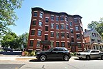
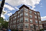
The Six Corners and Maple Heights neighborhoods are located in Springfield, Massachusetts. They are often combined for political purposes, although they feature dramatically different political and socioeconomic characteristics. The political entity known as Six Corners includes the architecturally significant Maple Heights and Ridgewood Historic Districts. Bordering the urban Metro Center neighborhood, several blocks south of Main Street, Maple Heights and the Ridgewood Historic District feature prominent mansions built along a high bluff overlooking the Connecticut River. From the 1820s until the 1910s, these districts were Springfield's street-car suburbs, and served as the city's first "Gold Coast."Mulberry Street, a tourist spot made famous by Springfield native Dr. Seuss's first children's book, "'And to Think that I Saw It on Mulberry Street,'" allows fans to follow in the steps of a young Dr. Seuss.Today, in these neighborhoods, one can view majestic gilded age mansions featuring original hand-crafted woodwork and ironwork that is unable to be replicated today. The Ridgewood District also contains Mulberry House, a 1950s futurist-style apartment building, now condominiums, with unparalleled views of Springfield's skyline. Behind Ridgewood Terrace and Mulberry House is the historic Springfield Cemetery, providing an oasis of green. Springfield's oldest private school, the MacDuffie School's historic campus is located in mansions on Maple Street.Six Corners, the neighborhood on the northern side of Springfield Cemetery is currently one of the city's most impoverished districts; however, the nearby Maple Heights, Ridgewood Historic District, and Mulberry Street look much as they did during the 19th century.

Masonic Temple (Springfield, Massachusetts)

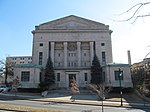
The Masonic Temple is an historic former Masonic building at 339–341 State Street in Springfield, Massachusetts. The four story Neo-Classical building was built in 1923 to serve as the headquarters of the local Masonic lodge. It occupies a prominent position opposite the Springfield Armory, just outside the downtown area. The building, which is no longer owned by the Masons, was listed on the National Register of Historic Places in 1983.The first Masonic lodge was established in Springfield in 1817. Between then and the early 1920s, Masonic organizations in the city met in a variety of places, including the town hall, and facilities in an insurance company building. The various lodges banded together to build their first dedicated space in 1893 at the corner of State and Main Streets. In the 1920s a fund drive was organized to construct a new facility. The firm of Edward McClintock and Charles Craig, both active Masons, was hired to design the building, which was built by A.E. Stephens beginning in October 1923, and formally dedicated in June 1924.Unlike the lodge built in 1893 (in which the ground floor contained retail space), the entire building was used for lodge purposes. The main entrance opened into a two-story foyer with marble floors and staircase, and was decorated with Greek Doric columns. The first floor housed two Blue Lodge facilities, one with space for 240 people the other for 450. Each of these rooms had inlaid cork floors and limestone walls, and house a pipe organ. The balance of the first floor included a reception area, and a meeting room for the lodge trustees. A mezzanine area had an office for the blue lodge secretary and a fireproof vault.The second floor housed a large space devoted to York Rite activities. The large space accommodated 500 people and was, like the first floor chambers, floored in inlaid cork, with limestone walls and a pipe organ. The chamber also had an arcade supported by pillars. Smaller offices and storage rooms line the remainder of this level, and there was again a mezzanine area with more storage. The third floor had the largest space in the building. With a capacity of 1,500, including 300 in a balcony, this chamber was used for Scottish Rite ceremonies, and featured a large and elaborate stage flanked by the pipes of an organ.On November 10, 1983, the building was listed on the National Register of Historic Places. It was acquired in 2007 by the Archdiocese of New England of the International Communion of the Holy Christian Orthodox Church, which made substantial renovations, converting some of the space into an art gallery, and repurposing others for religious use. The archdiocese had financial difficulties, and the property was sold at a foreclosure auction to its mortgage holder in January 2012.