Kamionek
Neighbourhoods of WarsawPraga-PołudnieWarsaw geography stubs

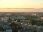
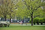
Kamionek, is a neighbourhood in Warsaw, located on the right bank of the Vistula river. Formerly a village, in the 19th century, with the beginning of the Industrial Revolution in this part of the Russian Empire, it was transformed into a textile industry center. Today it is part of Praga Południe, and most of its factories closed after the fall of the communism in Poland. It borders the Park Skaryszewski and Kamionek Lake to the south, Grochów to the east, and Praga to the north. During the November Uprising in 1831, the cemetery in Kamionek was the primary location where fallen soldiers of the Russian Army were buried.
Excerpt from the Wikipedia article Kamionek (License: CC BY-SA 3.0, Authors, Images).Kamionek
Stocka, Warsaw Praga-Południe (Warsaw)
Geographical coordinates (GPS) Address Nearby Places Show on map
Geographical coordinates (GPS)
| Latitude | Longitude |
|---|---|
| N 52.2417 ° | E 21.0836 ° |
Address
Stocka
Stocka
04-066 Warsaw, Praga-Południe (Warsaw)
Masovian Voivodeship, Poland
Open on Google Maps


