place

Wall railway station

1858 establishments in England1955 disestablishments in EnglandDisused railway stations in NorthumberlandFormer North British Railway stationsNorth East England railway station stubs
Pages with no open date in Infobox stationRailway stations in Great Britain closed in 1955Railway stations in Great Britain opened in 1858Use British English from August 2017Wall, Northumberland
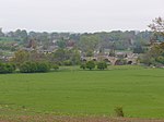
Wall Station geograph.org.uk 3099951

Wall railway station served the village of Wall, Northumberland, England from 1858 to 1955 on the Border Counties Railway.

Excerpt from the Wikipedia article Wall railway station (License: CC BY-SA 3.0, Authors, Images).

Wall railway station
Front Street,

Geographical coordinates (GPS) Address External links Nearby Places
placeShow on map

Wikipedia: Wall railway stationContinue reading on Wikipedia

Geographical coordinates (GPS)

Latitude Longitude
N 55.0101 ° E -2.1322 °
placeShow on map

Address

Wall

Front Street
NE46 4DT
England, United Kingdom
mapOpen on Google Maps

linkWikiData (Q38251987)
linkOpenStreetMap (10068088833)

Wall Station geograph.org.uk 3099951
Share experience

Nearby Places

Warden, Northumberland

Warden is a village in Northumberland, England about 2 miles (3 km) west of Hexham. The North and South Tyne meet near the village of Warden. There is a pleasant walk from the Boat Inn along the bank of the South Tyne to the meeting of the waters. The Boat Inn was formerly the site of a ferry until the toll bridge was built across the river. The toll house still stands, but the old bridge was replaced in 1904 by a County structure. The Newcastle and Carlisle Railway crosses the river by a strongly built iron bridge. Warden is dominated by the old motte, now tree covered, and higher still are the earthworks of a prehistoric fort. The church boasts one of the slender Anglo-Danish towers which are a feature of the Tyne valley. The churchyard appears oval in shape, which reinforces the notion of the great age of these Tyne parish centres. A carved stone stands close to the tower, but nothing more is claimed for it than being a "market cross". As, however, there is no record of a market here, inherently unlikely because of the proximity of Hexham market, a better case for its origin may be as one of the boundary crosses marking the sanctuary limits or "frith" of St Wilfrid's church at Hexham. The socket of one such cross survived near the road at Acomb. From Warden one can see eastwards among the trees which rise on the northern slope of the valley the spire of the Church of St John Lee on high ground at Acomb. It commemorates the hermitage of St John of Beverley, sometime bishop of Hexham (689-705). The present church is no older than 1818-85. From High Warden, on the hillside, a path leads to a large fortified British camp crowning the hill, which gives a fine outlook over the surrounding country.