place

Tucker Station, Louisville

Jefferson County, Kentucky geography stubsLouisville, Kentucky stubsNeighborhoods in Louisville, Kentucky
Louisville Skyline 2021 (3)

Tucker Station is a neighborhood of Louisville, Kentucky centered along Tucker Station Road and Rehl Road.

Excerpt from the Wikipedia article Tucker Station, Louisville (License: CC BY-SA 3.0, Authors, Images).

Tucker Station, Louisville
Tucker Station Road, Louisville

Geographical coordinates (GPS) Address Nearby Places
placeShow on map

Wikipedia: Tucker Station, LouisvilleContinue reading on Wikipedia

Geographical coordinates (GPS)

Latitude Longitude
N 38.2002 ° E -85.5279 °
placeShow on map

Address

Tucker Station Road 2801
40299 Louisville
Kentucky, United States
mapOpen on Google Maps

Louisville Skyline 2021 (3)
Share experience

Nearby Places

Blackacre Nature Preserve and Historic Homestead

Blackacre State Nature Preserve is a 271-acre (110 ha) nature preserve and historic homestead in Louisville, Kentucky. The preserve features rolling fields, streams, forests, and a homestead dating back to the 18th century. For visitors, the preserve features several farm animals including horses, goats, and cows, hiking trails, and a visitor's center in the 1844-built Presley Tyler home. Since 1981, it has been used by the Jefferson County Public Schools as the site of a continuing environmental education program. About 10,000 students visit the outdoor classroom each year. The preserve was created in 1979 when the land was given to the Office of Kentucky Nature Preserves by Judge Macauley and Mrs. Emilie Smith creating the first nature preserve in the Commonwealth's system. The Blackacre Conservancy, founded in 1983, operates the historic homestead and conducts cultural and historical programs while the Office retains ownership of the preserve and manages its natural resources. Blackacre is part of the old Moses Tyler farm, several original farm buildings remain, including the 1844 Presley Tyler home, an Appalachian-style barn and a reconstructed stone spring house. The entire 600-acre (240 ha) settlement has been named a national historic rural settlement. It was listed on the National Register of Historic Places as Tyler Settlement Rural Historic District in 1986.The name Blackacre is used as a generic name in legal contexts, particularly in law school and on bar exams, to refer to a parcel of land. The Smith family gave the land the name Blackacre; previously it was known as Land O'Skye.

Pope Lick Monster
Pope Lick Monster

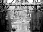
The Pope Lick Monster (more commonly, colloquially, the Goat Man) is a legendary part-man, part-goat and part-sheep creature reported to live beneath a railroad trestle bridge over Pope Lick Creek, in the Fisherville neighborhood of Louisville, Kentucky, United States.Numerous urban legends exist about the creature's origins and the methods it employs to claim its victims. According to some accounts, the creature uses either hypnosis or voice mimicry to lure trespassers onto the trestle to meet their death before an oncoming train. Other stories claim the monster jumps down from the trestle onto the roofs of cars passing beneath it. Yet other legends tell that it attacks its victims with a blood-stained axe and that the very sight of the creature is so unsettling that those who see it while walking across the high trestle are driven to leap off. Other legends hold that the monster is a human-goat hybrid, and that it was a circus freak who vowed revenge after being mistreated. In one version, it is said the monster escaped after a train derailed on the trestle. Another version commonly told by locals of the area claims that the monster is really the twisted reincarnated form of a farmer who sacrificed goats in exchange for Satanic powers.The legends have turned the area into a site for legend tripping. There have been a number of deaths and accidents at the trestle since its construction, despite the presence of an 8-foot (2.4 m) fence to keep thrill-seekers out.There is a common misconception that the trestle is abandoned and no longer used; in reality, the bridge carries a major rail artery into Louisville. Heavy freight trains cross the bridge several times daily, so it is easy for someone to get caught atop it while an oncoming train barrels down on them. Norfolk Southern Railway urged citizens not to climb the trestle, saying if caught they would be arrested.

Long Run massacre
Long Run massacre

The Long Run massacre occurred on 13 September 1781 at the intersection of Floyd's Fork creek with Long Run Creek, along the Falls Trace, a trail in what is now eastern Jefferson County, Kentucky. A day earlier, settlers at Painted Stone Station, established by Squire Boone, had learned that the fort was about to be raided by a large Indian war party under the command of Loyalist captain Alexander McKee. Most chose to abandon that station for the better defended ones near Beargrass Creek, and had left the injured Boone and one other family behind. Some settlers hesitated for two days before moving toward Linn's Station. Following the loss of part of their military guard, the party was ambushed at thirteen-mile tree, 8 miles (13 km) from Linn's Station. At least seven settlers were killed; Indian losses are unknown. The survivors fled and reached Linn's Station by nightfall. Despite historical markers and at least one published report indicating that at least 60 people were killed and only a few escaped, only about 15 settlers were actually killed, followed by 17 soldiers under Colonel John Floyd who were attacked the following day when they went to bury their remains. During the second engagement, however, a Wyandot chief present was killed, which led to the dispersal of the Indian forces and the end of McKee's raid.Reenactments are held annually in the Shelbyville, Kentucky area by the Painted Stone Settlers near the site of the massacre.