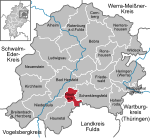
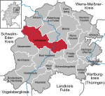
The Fulda Gap (German: Fulda-Lücke), an area between the Hesse-Thuringian border (the former Inner German border) and Frankfurt am Main, contains two corridors of lowlands through which tanks might have driven in a surprise attack by the Soviets and their Warsaw Pact allies to gain crossing(s) of the Rhine River. Named for the town of Fulda, the Fulda Gap became seen as strategically important during the Cold War of 1947–1991. The Fulda Gap roughly corresponds to the route along which Napoleon chose to withdraw his armies after defeat (16–19 October 1813) at the Battle of Leipzig. Napoleon succeeded in defeating a Bavarian-Austrian army under Wrede in the Battle of Hanau (30–31 October 1813) not far from Frankfurt; from there he escaped back to France.
From 1815, the area appeared of minimal strategic importance, as it lay deep within the borders of the German Confederation and (from 1871) of the German Empire, and German military planning presumed any war would be effectively lost long before an enemy reached that far into the homeland. The route became important again at the end of World War II when the U.S. XII Corps used it in their advance eastward in late March and early April 1945. The U.S. advance had little consequence for Germany's strategic position (which was indeed hopeless by that point), but it allowed the Americans to occupy vast swaths of territory which the Yalta Conference of February 1945 had assigned to the Soviet occupation zone. This in turn did much to compel the Soviets to honor the Yalta Conference agreement meaning that Western Allies got access to Berlin. In exchange the U.S. Army withdrew in July 1945 from Thuringia and Saxony to the line agreed upon in Yalta.
During the Cold War, the Fulda Gap offered one of the two obvious routes for a hypothetical Soviet tank attack on West Germany from Eastern Europe (especially from East Germany); the other route crossed the North German Plain. A third, less likely, route involved travelling up through the Danube River valley through neutral Austria. The concept of a major tank battle along the Fulda Gap became a predominant element of NATO war planning during the Cold War. With such an eventuality in mind, weapons were evolved such as nuclear tube and missile artillery, the nuclear recoilless gun/tactical launcher Davy Crockett, Special Atomic Demolition Munitions, the AH-64 Apache attack helicopter, and A-10 ground attack aircraft.


