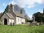
Church Farmhouse, Kemeys Commander
Buildings and structures in MonmouthshireCountry houses in WalesGrade II* listed buildings in Monmouthshire

Church Farmhouse, Kemeys Commander, Monmouthshire is a former parsonage dating from the mid-16th century. The farmhouse and the attached barn are Grade II* listed buildings.
Excerpt from the Wikipedia article Church Farmhouse, Kemeys Commander (License: CC BY-SA 3.0, Authors, Images).Church Farmhouse, Kemeys Commander
Church Lane,
Geographical coordinates (GPS) Address Nearby Places Show on map
Geographical coordinates (GPS)
| Latitude | Longitude |
|---|---|
| N 51.73742 ° | E -2.94422 ° |
Address
Church of All Saints, Kemeys Commander
Church Lane
NP15 1JU , Llanarth
Wales, United Kingdom
Open on Google Maps


