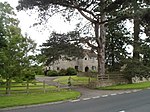
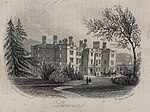
Penpergwm railway station
Disused railway stations in MonmouthshireFormer Great Western Railway stationsPages with no open date in Infobox stationRailway stations in Great Britain closed in 1854Railway stations in Great Britain closed in 1958 ... and 1 more
Use British English from February 2022

Penpergwm railway station was a former station which served the Monmouthshire, Wales, village of Penpergwm, although the community adjacent to the station was very small and it could equally be said to have served the larger village of Llangattock Nigh Usk (Llangatwg Dyffryn Wysg in Welsh) which lay less than half a mile away to the east. It was located on the Welsh Marches Line between Pontypool (formerly Pontypool Road) and Abergavenny. The former station house is now a private residence.The station closed in 1958. The double line remains in use and carries a regular service of trains between Cardiff, Newport and Hereford.
Excerpt from the Wikipedia article Penpergwm railway station (License: CC BY-SA 3.0, Authors, Images).Penpergwm railway station
A40,
Geographical coordinates (GPS) Address External links Nearby Places Show on map
Geographical coordinates (GPS)
| Latitude | Longitude |
|---|---|
| N 51.7846 ° | E -2.9793 ° |
Address
Penpergwm
A40
NP7 9AH , Gobion Fawr
Wales, United Kingdom
Open on Google Maps


