place

Althagen

Villages in Mecklenburg-Western PomeraniaVorpommern-Rügen
Haus in Althagen geo en.hlipp.de 11800

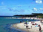
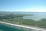
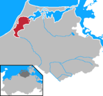
The village of Althagen on the peninsula of Fischland-Darß-Zingst in the German state of Mecklenburg-Vorpommern has been a part of the municipality of Ahrenshoop since 1950. Until 1945, the border between Mecklenburg and Pomerania ran between Althagen and Ahrenshoop along the border road, Grenzweg. The Bakelberg knoll lies close to the steep coast of Althagen/Niehagen. At 17.9 metres above sea level, it is the highest point on Fischland. Althagen has a port on the bodden coast.Well known residents of Althagen include the designer, Gertrud Kleinhempel (1875-1948), the writer, Käthe Miethe (1893-1961) and (from 1944) the well-known artist couple Fritz Koch-Gotha (1877-1956) and Dora Koch-Stetter (1881-1968). Koch-Stetter's 1911 expressionist painting, The red house in Althagen, is one of her most famous works to this day. From 1955, Fischland Pottery (Fischlandkeramik), was developed in their ceramics workshoops by the next generation of the artist family of Koch [-Gotha and -Stetter], artist and potter, Barbara Klünder (1919-1988), and her husband, the artist Arnold Klünder (1909-1976) together with artist, Frida Löber (1910-1989) and the sculptor and potter, Wilhelm Löber (1903-1981).

Excerpt from the Wikipedia article Althagen (License: CC BY-SA 3.0, Authors, Images).

Althagen
Töpferweg, Darß/Fischland

Geographical coordinates (GPS) Address Nearby Places
placeShow on map

Wikipedia: AlthagenContinue reading on Wikipedia

Geographical coordinates (GPS)

Latitude Longitude
N 54.373198 ° E 12.417494 °
placeShow on map

Address

Töpferweg 3b
18347 Darß/Fischland
Mecklenburg-Vorpommern, Germany
mapOpen on Google Maps

Haus in Althagen geo en.hlipp.de 11800
Share experience

Nearby Places

Permin
Permin

The Permin is a bay in the Saaler Bodden lagoon south of Wustrow in northeast Germany. Originally, the Permin was a channel between the Saaler Bodden and the Baltic Sea and the southern estuarine channel of the River Recknitz. It borders on the Fischland in the south.Because the Permin was navigable in the 13th and 14th centuries with average water depths of around 2 to 3 metres, it formed an important waterway for trade to and from the towns of Ribnitz and Barth, although its navigability was frequently degraded by storms and silting up. Although the Permin was only suitable for smaller ships and mainly used by the population of the local region to ply their trade in small, open boats, the Hanseatic League believed its trading privileges were being affected. Moreover, at the end of the 14th century, trade in the Baltic was heavily disrupted by the Victual Brothers, who were supported by the Mecklenburg dukes and the Pomeranian Duke Barnim VI from time to time. The Victual Brothers used the Permin and the Loop near Ahrenshoop to enter the waters of the various boddens, which they used as a retreat in between their privateering. In 1392 or 1393 the Hanseatic town of Rostock had the port of Ahrenshoop destroyed and dammed the Loop. In 1400, the Hanseatic town of Stralsund had three ships sunk in the Permin, which accelerated the siltation of the channel and made it unnavigable. So by the turn of the 14th and 15th centuries both links between the bodden and the sea were closed. Whether they were re-opened has not been passed down. It was not until 1625 that the Loop was torn wide open and deeply by the storm flood; nothing is known about the Permin, but it can be assumed that this even weaker stretch of coast was also significantly affected. In 1872, a storm flood drove a creek or tidal inlet 15 metres wide and 5 metres deep in the area of the Permin. In order to join the two parts of the mainland on either side, an emergency bridge had to be erected.Even today this section of coast is classified as severely endangered during floods, which is why coastal protection measures are planned.

Fischland
Fischland

Fischland (literally "fish land") is an isthmus on the southern Baltic Sea coast on the Bay of Mecklenburg in northeastern Germany. It is part of the peninsula of Fischland-Darß-Zingst. Fischland was an island until the 14th century and was bounded by the navigable estuarine branches of the River Recknitz: the Permin in the south and the Loop in the north. In more recent times its southern boundary has usually been considered to be the Recknitz Meadowland (Recknitzer Stadtwiesen) and the Rostock Heath (Rostocker Heide). To the west and east its boundaries are more obvious: on the one side is its active cliffed coast on the Baltic, and on the other the coastline alongside the Saaler Bodden, only a few centimetres above sea level. Fischland is about 5 km long, between 500 metres and 2 km wide and runs from southwest to northeast. The Pleistocene island core, which is subjected to marked changes as a result of water and wind action, consists of glacial sands (Geschiebesanden) and till and forms part of a graded shoreline. Not until the end of the 14th century were the two existing channels between the Baltic Sea and the lagoon or bodden filled in by the Hanseatic League in order to make access to the sea more difficult for their rival, Ribnitz. As a result, Fischland and Darß became a peninsula. Today storms carry away an average of half a metre of coast per year from Fischland, depositing it again further north at Darßer Ort. Without major coastal defence measures the narrow isthmus would probably have long since been destroyed. Near the steep coastline of Althagen/Niehagen lies the eminence of Bakelberg. At 17.9 metres above sea level (NN) it is the highest elevation on Fischland. There is a total of just four settlements on Fischland, which have largely merged with one another today: the Ahrenshoop villages of Althagen and Niehagen as the municipality of Wustrow with the village of Barnstorf. The village of Ahrenshoop, well known as a residence and holiday resort for artists, on West Pomeranian soil is not on Fischland, however, but on the Vordarß. To the north Fischland is bounded by the present-day boundary trail (Grenzweg) in the municipality of Ahrenshoop. This used to be the site of the Loop, an inlet that marked the border between Mecklenburg and Pomerania; until recent times it continued to form the border between the Mecklenburg and Pomeranian State Churches.

Saal, Mecklenburg-Vorpommern

Saal is a municipality in the Vorpommern-Rügen district, in Mecklenburg-Vorpommern, Germany. The community is under administration of the small city of Barth. Saal has first been documented in a deed of the city of Barth in the year of 1255. At this time there was an already abandoned Slavic castle by the mouth of the Saal creek into the Saal “bodden”. The population around 1255 consisted of indigenous Slav, migrants from Westphalia and Denmark. The first church already existed and was completely made of wood and sanctified to the “Holy Cross”. From today's village Tempel, at the time a commandery, knights templar arrived at Saal. The order of knights was in search to expanding Northeast, and had to take provisions securing its continuity as the Holy Land was lost. The order induced the erection of the church, which until this date dominates impressively the scenery and gives a different impression of Gothic architecture. Everything at this church is characterized by ‘shiftings’: windows, portals. The frayed walls are evidence of both planned or symbolic annexes and continued constructions. The entry to the underground walkway, behind the altar, can still be seen. It is said to end somewhere by the “bodden”. Underneath the bell tower (1731) standing aside from the actual church, is a hollow space, which however, had never been explored. According to the legend a part of the templar treasure was brought here around 1300. One of the templar stole a part of the treasure and hid it in one of the column foundations. It was said to be the vanished imperial regalia of John Lackland, which he lost in unclear circumstances in 1216. Legend: Until 1309 the templar rebuilt the castle at the „bodden“ and used it as a port facility. Today, only the castle ramparts testify of the once great times. The Vitalian Brotherhood under Stoertebeker (.../succession order of the templar in Portugal) had used the castle until 1391 and are said to have brought the treasure under the bell tower to this place. After they were involved in a fight with the Danes on the Ribnitz Sea, they had to flee and never returned to Saal. The treasure is said to be still somewhere there. Today the templar in Saal are forgotten; only Stoertebeker is sometimes spoken about. Suggestion: Who ever comes to Saal, should not miss visiting an ancient stone circle, the apostle stones.

Recknitz
Recknitz

The Recknitz (historically known as Raxa) is a river in Mecklenburg-Vorpommern in northeastern Germany. The Recknitz's glacial valley stretches as far south as the heights at Glasewitz near Güstrow. The river has no definite source, but rather builds up from streams and drainage ditches. The ditches of the Schaalbeke and Pludderbach have their water flow split between Liessow and Laage, but most of the water flows north as the Recknitz, while the lesser flow, called the Augraben, runs south to the river Nebel. The lower Recknitz (from Ribnitz-Damgarten to Bad Sülze) is the historic boundary between Mecklenburg and Vorpommern. Nowadays, however, it is only a boundary between the Mecklenburg Regional Evangelical-Lutheran Church and the Pomeranian Evangelical Church. Starting at Tessin, the Recknitz is navigable by canoe the year round. A number of measures have been undertaken along the river's course to restore the natural environment. Along one stretch of 30 km, three sections of riverside have been declared nature protection areas. The Recknitz empties into the Saaler Bodden, the coastal waters of the Baltic Sea near Ribnitz-Damgarten. In October 955 A.D. the vicinity of river was the site of famous Schlacht an der Raxa (Battle of Recknitz) between the German (Saxons and Frisians) army of Emperor Otto I of Germany commanded by Gero the Great and the Obodrite and other Polabian Slavs warriors army under prince Stoigniew, brother of prince Nakon.