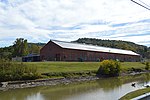
Dunkard Creek is a stream that flows 36.9 miles (59.4 km) through Greene County, Pennsylvania and Monongalia County, West Virginia, near the towns of Mount Morris, Pennsylvania, and Blacksville, West Virginia. It flows into the Monongahela River northwest of Point Marion, Pennsylvania, approximately three miles north of the Pennsylvania-West Virginia border.
Mason-Dixon Historical Park is located on the banks of Dunkard Creek in an area where the creek crosses the border three times in less than one mile. The park grounds include Brown's Hill, the westernmost site from which Charles Mason and Jeremiah Dixon made astronomical observations during the original survey of the Pennsylvania–Maryland border in 1767.The creek is named for members of the Dunkard Brethren, a pacifist, nonconformist group of Christians who settled in the region during the 18th century and practiced baptism by immersion. The Pennsylvania German word for "immerse" is dunke and people who immerse are called dunker.
In September 2009, Dunkard Creek suffered a massive fish kill resulting in the death of more than 160 species of fish, salamanders and endangered mussels in the creek. The West Virginia Department of Environmental Protection determined that an algal bloom was responsible for the loss. The bloom is believed to have been possible as a result of high chloride and salt levels in the water. A Consol Energy mine discharge site on the creek is the likeliest source of contamination. The Shannopin Mine in the Bobtown area of Dunkard Township also discharges into Dunkard Creek. Since at least 2002, the West Virginia DEP had known about and been pressured by environmental groups to take action on high levels of chlorides and other contaminants in the Blacksville No. 2 outfall, but they took no action against Consol.
In March 2011, Consol Energy reached an agreement with the US EPA and the State of West Virginia regarding damage done to Dunkard Creek caused by high levels of TDS in the discharge from their Blacksville No. 2 mine. As part of that settlement, Consol agreed to pay $5.5 million in civil penalties for pollution violations related to the 2009 fish kill. The settlement also describes requirements for Consol to complete a new, $200 million water treatment system to better control pollution discharges from its active and former mining operations in the area.
In July 2015, Consol Energy reached a settlement with the PA Fish and Boat Commission, agreeing to pay $2.5 million for the damages to the Pennsylvania portion of Dunkard Creek. The commission plans to use this money to restore the fish population in the creek and support recreational fishing and boating projects.


