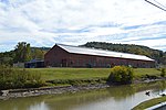
Point Marion Lock and Dam
Buildings and structures in Fayette County, PennsylvaniaBuildings and structures in Greene County, PennsylvaniaCrossings of the Monongahela RiverDams completed in 1926Dams in Pennsylvania ... and 4 more
Transportation buildings and structures in Fayette County, PennsylvaniaTransportation buildings and structures in Greene County, PennsylvaniaUnited States Army Corps of Engineers, Pittsburgh DistrictUnited States Army Corps of Engineers dams

Point Marion Lock and Dam, previously known as Lock and Dam Number 8, is one of nine navigational structures on the Monongahela River between Pittsburgh, Pennsylvania and Fairmont, West Virginia. Maintained and built by the U.S. Army Corps of Engineers, the gated dam forms an upstream pool that is 11.2 miles (18.0 km) long, stretching to the base of the Morgantown Lock and Dam. It is located at river mile 90.5 (river kilometer 145.6). There is one lock chamber on the left descending bank of the river at the dam, 84 feet (26 m) wide and 720 feet (220 m) long. The reservoir formed by the dam is also a municipal and industrial water supply.
Excerpt from the Wikipedia article Point Marion Lock and Dam (License: CC BY-SA 3.0, Authors, Images).Point Marion Lock and Dam
Sheepskin Trail, Springhill Township
Geographical coordinates (GPS) Address Nearby Places Show on map
Geographical coordinates (GPS)
| Latitude | Longitude |
|---|---|
| N 39.727222222222 ° | E -79.910833333333 ° |
Address
Sheepskin Trail
Sheepskin Trail
15474 Springhill Township
Pennsylvania, United States
Open on Google Maps


