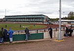
Oakdale, Dorset
Areas of PooleDorset geography stubs

Oakdale is a suburb of Poole in Dorset, England with a population of 10,949, increasing to 11,554 at the 2011 Census and shares boundaries with Creekmoor, Poole Town, Parkstone, Newtown and Canford Heath
Excerpt from the Wikipedia article Oakdale, Dorset (License: CC BY-SA 3.0, Authors, Images).Oakdale, Dorset
Wimborne Road,
Geographical coordinates (GPS) Address Nearby Places Show on map
Geographical coordinates (GPS)
| Latitude | Longitude |
|---|---|
| N 50.732861111111 ° | E -1.9780277777778 ° |
Address
American Fried Chicken
Wimborne Road 317
BH15 3DH , Oakdale
England, United Kingdom
Open on Google Maps


