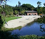
Claremont Canyon Regional Preserve
Berkeley HillsEast Bay Regional Park DistrictParks in Oakland, California

Claremont Canyon Regional Preserve is a small regional park mainly located in the city of Oakland, California, and administered by the East Bay Regional Park District. The park is named for the canyon in which it is situated, Claremont Canyon, out of which Claremont Creek flows on its way to its confluence with Temescal Creek. Originally, the canyon was named Harwood's Canyon, and then later as Telegraph Canyon. The name was changed to Claremont by a developer of the nearby Claremont district.
Excerpt from the Wikipedia article Claremont Canyon Regional Preserve (License: CC BY-SA 3.0, Authors, Images).Claremont Canyon Regional Preserve
Gwin Caynon Trail, Oakland
Geographical coordinates (GPS) Address Nearby Places Show on map
Geographical coordinates (GPS)
| Latitude | Longitude |
|---|---|
| N 37.865203 ° | E -122.225801 ° |
Address
Gwin Caynon Trail
Gwin Caynon Trail
94720 Oakland
California, United States
Open on Google Maps


