place

University of California Botanical Garden

Berkeley HillsBotanical gardens in CaliforniaParks in Oakland, CaliforniaTourist attractions in Alameda County, CaliforniaUniversity of California, Berkeley buildings
Use mdy dates from July 2019
Botanischer Garten in Berkeley, California

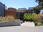
The University of California Botanical Garden is a 34-acre (13.7 ha) botanical garden located on the University of California, Berkeley campus, in Strawberry Canyon. The Garden is in the Berkeley Hills, inside the city boundary of Oakland, with views overlooking the San Francisco Bay. It is one of the most diverse plant collections in the United States, and famous for its large number of rare and endangered species.

Excerpt from the Wikipedia article University of California Botanical Garden (License: CC BY-SA 3.0, Authors, Images).

University of California Botanical Garden
Centennial Drive, Oakland

Geographical coordinates (GPS) Address Nearby Places
placeShow on map

Wikipedia: University of California Botanical GardenContinue reading on Wikipedia

Geographical coordinates (GPS)

Latitude Longitude
N 37.875 ° E -122.2375 °
placeShow on map

Address

Southern Africa

Centennial Drive
94720 Oakland
California, United States
mapOpen on Google Maps

Botanischer Garten in Berkeley, California
Share experience

Nearby Places

Grizzly Peak (Berkeley Hills)

Grizzly Peak is a summit in the Berkeley Hills above Berkeley, California. The peak is located on the border between Alameda and Contra Costa counties, within the boundaries of Tilden Regional Park, and directly behind the University of California, Berkeley campus. The peak was named for the California grizzly bear which inhabited the local area until the late 1800s. The last sighting locally was by a man who was reportedly killed by a grizzly in Strawberry Canyon below Grizzly Peak in the 1860s. The first local killing of a grizzly by a European occurred in 1772, also along Strawberry Creek just west of what is today the UC Berkeley campus, within what is now downtown Berkeley. The shooting by Spanish soldiers was recorded by Father Juan Crespi. The last grizzly in all of California was killed in the Sierra foothills east of Fresno in August 1922.Grizzly Peak became more accessible in 1932 when Grizzly Peak Boulevard was constructed along the ridge line of the Berkeley Hills. The name was extended to the previously-constructed ridge line stretch of Euclid Avenue to the north shortly thereafter. This portion was and remains a residential area of Berkeley while the original stretch is largely undeveloped. Grizzly Peak Boulevard now extends from Kenyon Avenue in Kensington in the north, through Berkeley and Oakland to an intersection with Skyline Blvd. above Oakland to the south. Before Grizzly Peak Boulevard was constructed, the location of its current intersection with Claremont (before 1892 known as Telegraph Road) and Fish Ranch Road was historically an important pass through the Berkeley Hills, before the tunnel that preceded today's Caldecott Tunnel was constructed through the hills in 1903; an inn and stage stop called the Summit House was located here. Today, Grizzly Peak is a popular location for people to get a unique view of the Golden Gate Bridge and the surrounding Bay Area. It is also common to see street luge enthusiasts in this area and down the canyon into Berkeley from Skyline Boulevard and Claremont Avenue.