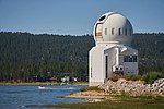
Big Bear Lake
Big Bear ValleyCalifornia Historical LandmarksReservoirs in CaliforniaReservoirs in San Bernardino County, CaliforniaReservoirs in Southern California ... and 4 more
San Bernardino MountainsSan Bernardino National ForestTourist attractions in San Bernardino County, CaliforniaUse mdy dates from June 2022

Big Bear Lake is a reservoir in the western United States, located in the San Bernardino Mountains in San Bernardino County, California. It is a snow and rain-fed lake, having no other means of tributaries or mechanical replenishment. At a surface elevation of 6,743 ft (2,055 m) above sea level, it has an east–west length of approximately seven miles (11 km) and is approximately 2.5 miles (4.0 km) at its widest measurement, though the lake's width mostly averages a little more than 1⁄2 mi (0.8 km). These approximations are based on the lake having an optimum retainable water level. At dam's end, Big Bear measures its deepest water at 72 feet (22 m).
Excerpt from the Wikipedia article Big Bear Lake (License: CC BY-SA 3.0, Authors, Images).Big Bear Lake
Big Bear Bridge,
Geographical coordinates (GPS) Address Nearby Places Show on map
Geographical coordinates (GPS)
| Latitude | Longitude |
|---|---|
| N 34.241944444444 ° | E -116.97694444444 ° |
Address
Big Bear Bridge
Big Bear Bridge
California, United States
Open on Google Maps


