place

Llandrinio Road railway station

Disused railway stations in PowysPages with no open date in Infobox stationRailway stations in Great Britain closed in 1932Railway stations in Great Britain opened in 1871Use British English from October 2022
Wales railway station stubs

Llandrinio Road railway station was a station to the northeast of Criggion, Powys, Wales. The station opened in 1871 and closed in 1932. The station was sited a mile to the south east of Llandrinio at Criggion Bridge on the road to Crew Green hence the "Road" suffix. There was a single brick platform on the west side of the road level crossing with a goods siding on the north side of the line.

Excerpt from the Wikipedia article Llandrinio Road railway station (License: CC BY-SA 3.0, Authors).

Llandrinio Road railway station
B4393,

Geographical coordinates (GPS) Address External links Nearby Places
placeShow on map

Wikipedia: Llandrinio Road railway stationContinue reading on Wikipedia

Geographical coordinates (GPS)

Latitude Longitude
N 52.7348 ° E -3.0263 °
placeShow on map

Address

Llandrinio Road

B4393
SY5 9BG , Bausley with Criggion
Wales, United Kingdom
mapOpen on Google Maps

linkWikiData (Q28971148)
linkOpenStreetMap (4630851036)

Share experience

Nearby Places

Breidden Hill
Breidden Hill

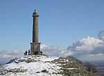
Breidden Hill is an extinct volcanic hill in Powys, Wales, near the town of Welshpool. It is immediately surrounded by the villages of Trewern, Middletown, Criggion, Crew Green and Llandrinio. The peak of the hill reaches to 367 metres (1,204 ft). Footpaths which lead up to the summit provide excellent 360 degree views over Powys and over the border with England to the Shropshire Plain. Breidden Hill is one of five peaks with neighbouring Moel y Golfa, which is the highest at 403 metres (1,322 ft), which is a "Marilyn", with a prominence of 261 metres (856 ft). The three others are Cefn y Castell (also known as Middletown Hill), Kempsters Hill and Bausley Hill (all over 800 feet (240 m) high) with its Iron Age galleried fortification. The five hills are sometimes collectively known as the Breidden Hills, and form a northern extension of the Long Mountain. There are remains of a British Iron Age hillfort en route which may have been the site of the last stand of Caractacus. Rodney's Pillar at the top was built by the gentlemen of Montgomeryshire who supplied oak wood from the area and shipped it down the River Severn (which runs nearby at Bausley with Criggion) to Bristol where Admiral Rodney's naval fleet was built. Rodney's Pillar is increasingly being used as a navigational aid by helicopter pilots in this area, due to its visibility from large areas of Wales. Beginning around 1789, for many years members of the Breidden Society, founded by John Dovaston (1740–1808), met near Rodney's Pillar for an annual festival of food, drink, poetry, and song; records of their meetings for 1809–15 are preserved at the Houghton Library of Harvard University (MS Eng 1168).There is a large quarry on the western and northern sides of Breidden Hill. The rock is a thick gabbroic-dolerite laccolith, which is a source of roadstone.On 27 June 2018, a wildfire broke out on Breidden Hill, destroying an area of grassland close to Rodney's Pillar.