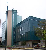
Grasbroek
HeerlenLimburg (Netherlands) geography stubsMining communities in the Netherlands

Grasbroek is a neighbourhood and former mining colony in the municipality Heerlen, Netherlands. The neighbourhood was built to serve the mine Oranje-Nassau I. Grasbroek houses the Patronaatsgebouw (Jos Wielders (1883–1949)), build in 1920 it is one of the earliest examples of Amsterdam School outside Amsterdam. Besides being in a state of disrepair all almost all original elements remain. Currently it is being restored, restoringcost around 3,500,000 euros
Excerpt from the Wikipedia article Grasbroek (License: CC BY-SA 3.0, Authors, Images).Grasbroek
Boerhaavestraat, Heerlen
Geographical coordinates (GPS) Address Nearby Places Show on map
Geographical coordinates (GPS)
| Latitude | Longitude |
|---|---|
| N 50.89705 ° | E 5.975844 ° |
Address
Grasbroek
Boerhaavestraat
6412 VJ Heerlen
Limburg, Netherlands
Open on Google Maps

