Marne (estuary)

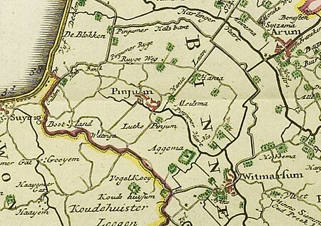
The Marneslenk (Dutch), or Marneslinke (Frisian), or Marne estuary, was a former estuary in western Friesland south of Harlingen, now reclaimed to be farmland. It formed around the year 300 AD, when rising sea levels also enlarged the Almere lake to the southwest, and formed the Middelzee to the east. The Marneslenk had its mouth on the Vlie and stretched southeasterly to the area of Tirns and then headed east to the Middelzee. Between 1100 and 1300 AD the watercourse was reclaimed and turned into fields by the construction of dykes. One such dyke is the Pingjumer Gulden Halsband. The Bedelaarsvaart (Bidlersfeart) and Harnzerfeartis are what remains of this watercourse nowadays.
Excerpt from the Wikipedia article Marne (estuary) (License: CC BY-SA 3.0, Authors, Images).Marne (estuary)
Riegeweg, Súdwest-Fryslân
Geographical coordinates (GPS) Address Nearby Places Show on map
Geographical coordinates (GPS)
| Latitude | Longitude |
|---|---|
| N 53.125 ° | E 5.4333333333333 ° |
Address
Riegeweg
Riegeweg
8749 TD Súdwest-Fryslân
Frisia, Netherlands
Open on Google Maps


