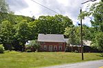
Williams River State Forest
Chester, VermontNortheastern United States protected area stubsProtected areas of Windham County, VermontVermont geography stubsVermont state forests
Williams River State Forest covers 108 acres (0.44 km2) in Chester in Windham County, Vermont. The forest is managed by the Vermont Department of Forests, Parks, and Recreation.Activities in the forest include hiking, snowshoeing, hunting and wildlife viewing. The south branch of Williams River (Vermont) flows along the edge of the forest.
Excerpt from the Wikipedia article Williams River State Forest (License: CC BY-SA 3.0, Authors).Williams River State Forest
Popple Dungeon Road,
Geographical coordinates (GPS) Address Nearby Places Show on map
Geographical coordinates (GPS)
| Latitude | Longitude |
|---|---|
| N 43.2333 ° | E -72.6695 ° |
Address
Popple Dungeon Road
Popple Dungeon Road
05143
Vermont, United States
Open on Google Maps


