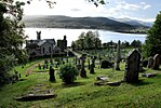
Rashfield
Argyll and Bute geography stubsVillages in Cowal
Rashfield; is a hamlet on the Cowal peninsula, situated between Loch Eck and the head of Holy Loch, in Argyll and Bute, West of Scotland. The hamlet is on the A815 road and the River Eachaig flows pass from Loch Eck to the Holy Loch. Rashfield is within the Argyll Forest Park which is itself within the Loch Lomond and The Trossachs National Park.
Excerpt from the Wikipedia article Rashfield (License: CC BY-SA 3.0, Authors).Rashfield
A815,
Geographical coordinates (GPS) Address Nearby Places Show on map
Geographical coordinates (GPS)
| Latitude | Longitude |
|---|---|
| N 56.009011 ° | E -4.9732852 ° |
Address
A815
PA23 8QT
Scotland, United Kingdom
Open on Google Maps


