Reich Ministry of Transport

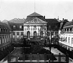
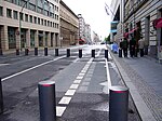
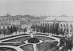
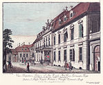
The Reich Ministry of Transport (German: Reichsverkehrsministerium or RVM) was a cabinet-level agency of the German government from 1919 until 1945, operating during the Weimar Republic and Nazi Germany. Formed from the Prussian Ministry of Public Works after the end of World War I, the RVM was in charge of regulating German railways, roadways, waterways, and the construction industry - a kind of infrastructure agency in today's understanding. In the 1920s, the Ministry's involvement in the rail sector was limited to administrative and technical supervisory functions. The National Railway (Deutsche Reichsbahn) was initially organized as an independent state-owned company to guarantee that Germany paid war reparations according to the provisions of the 1924 Dawes Plan. Under Nazi control, the Transport Ministry expanded exponentially. The Reichsbahn, which had become Germany's largest public asset and also the largest such enterprise in the capitalist world at the time, was taken over by the RVM in 1937. Railroads in the German states, transportation associations, and even private transport companies also came under the Nazi government's direct control through the Ministry. During World War II the RVM took over agencies in conquered nations and provided military rail transport. It also became responsible for the deportation of European Jews to extermination camps. The particular unit involved, "No. 21. Bulk Transport", functioned in close cooperation with the SS. The RVM therefore came to play a pivotal role in The Holocaust. The Ministry lived on for a time after the war in the Flensburg Government and was dissolved de facto at the end of May, 1945. The Ministry's headquarters were located in central Berlin on the Wilhelmplatz. Over time it came to occupy a complex of buildings, including underground air-raid shelters built in 1940. Heavily damaged by Allied bombing, the site wound up in East Berlin in 1949. Portions of it served as the East German Railway headquarters until German Reunification in 1990. Most of the site was left derelict and was demolished in 2012. A large shopping mall was built in its place in 2014, with two small wings historically preserved.
Excerpt from the Wikipedia article Reich Ministry of Transport (License: CC BY-SA 3.0, Authors, Images).Reich Ministry of Transport
Leipziger Platz, Berlin Mitte
Geographical coordinates (GPS) Address Phone number Website Nearby Places Show on map
Geographical coordinates (GPS)
| Latitude | Longitude |
|---|---|
| N 52.510555555556 ° | E 13.382777777778 ° |
Address
Mall of Berlin (LP12 (Leipziger Pl. 12))
Leipziger Platz 12
10117 Berlin, Mitte
Germany
Open on Google Maps


