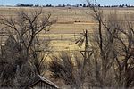
Lake Estancia was a lake formed in the Estancia Valley, central New Mexico, which left various coastal landforms in the valley. The lake was mostly fed by creek and groundwater from the Manzano Mountains, and fluctuated between freshwater stages and saltier stages. The lake had a diverse fauna, including cutthroat trout; they may have reached it during a possible past stage where it was overflowing.
Lake Estancia appears to have formed between the Pliocene and Pleistocene, when a previous river system broke up. It reached a maximum water level ("highstand") presumably during the Illinoian glaciation and subsequently fluctuated between fuller stages and a desiccated basin. Around the Last Glacial Maximum (LGM) time interval, several highstands and a low water level state occurred during the "Big Dry" climate interval. Between 16,100 and 14,500 years ago the lake reached its highest stand of the last 30,000 years before drying up again during the Bølling-Allerød climate interval. The lake briefly returned during the Younger Dryas climate interval and eventually desiccated after about 8,500 years ago during the Holocene. Wind-driven erosion has excavated depressions in the former lakebed that are in part filled with playas (dry lake beds).
The lake was one of several pluvial lakes in southwestern North America that developed during the late Pleistocene. Their formation has been variously attributed to decreased temperatures during the ice age and increased precipitation; a shutdown of the thermohaline circulation and the Laurentide Ice Sheet altered atmospheric circulation patterns and increased precipitation in the region. The lake has yielded a good paleoclimatic record.
 Continue reading on Wikipedia