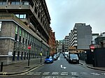
Norfolk Street, Strand
Former streets and roads of LondonStreets in the City of Westminster

Norfolk Street in the Liberty of the Savoy (between Westminster and the City of London) ran from Strand in the north to the Westminster reach of the Thames. It then ran to a strand of public gardens after the Victoria Embankment was built (1865–70), what is now Temple Place. It was crossed only by Howard Street. It was demolished in the 1970s.
Excerpt from the Wikipedia article Norfolk Street, Strand (License: CC BY-SA 3.0, Authors, Images).Norfolk Street, Strand
Arundel Street, City of Westminster Holborn
Geographical coordinates (GPS) Address Nearby Places Show on map
Geographical coordinates (GPS)
| Latitude | Longitude |
|---|---|
| N 51.511838888889 ° | E -0.11468055555556 ° |
Address
Arundel Street 2
WC2R 3DX City of Westminster, Holborn
England, United Kingdom
Open on Google Maps


