place

St. Margaret's Church, Great Barr

Grade II listed churches in the West Midlands (county)Great Barr
Great Barr parish church geograph.org.uk 33516

The Church Of St Margaret (also known as St Margaret's Church), is the Anglican parish church of Great Barr and is located on Chapel Lane, Walsall, England. It is dedicated to Saint Margaret of Antioch. The church was rebuilt in 1862, by Griffin. The tower was built of brick in 1677, but this is completely hidden by a Gothic revival red sandstone casing added in 1893. The spire is 18th-century. The pulpit, in alabaster, was made to a design by Walter Tapper. The church was granted Grade II listed status in July 1986, legally protecting it from unauthorised alteration or demolition. Its war memorial, described by Historic England as "a lantern cross in the medieval style", was separately listed, also at Grade II, in April 2016.The church was historically in Staffordshire, and so its historic records are lodged with Staffordshire Record Office.The church gives its name to the nearby St Margaret's Church of England Primary School, and to the former St Margaret's hospital in the adjacent grounds of Great Barr Hall.

Excerpt from the Wikipedia article St. Margaret's Church, Great Barr (License: CC BY-SA 3.0, Authors, Images).

St. Margaret's Church, Great Barr
Chapel Lane,

Geographical coordinates (GPS) Address Nearby Places
placeShow on map

Wikipedia: St. Margaret's Church, Great BarrContinue reading on Wikipedia

Geographical coordinates (GPS)

Latitude Longitude
N 52.560015 ° E -1.930628 °
placeShow on map

Address

Chapel Lane

Chapel Lane
B43 7BB
England, United Kingdom
mapOpen on Google Maps

Great Barr parish church geograph.org.uk 33516
Share experience

Nearby Places

Queslett
Queslett

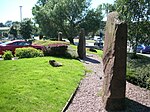
Queslett is an area of Great Barr, Birmingham, England. The name (originally Quieslade) has been in use since the 16th century. The first part, from "Queest", means a wood pigeon, the second comes from the Anglo-Saxon "slade", for a small valley. Another old spelling, Queeslet, appears on Victorian maps and postcards. The area was part of Staffordshire until 1928. In 1810, in A Complete History of the Druids, T G Lomax described the area: At the declivity of very pleasingly diversified hills, near Quieslade, is a most delightful lake, by crossing the head of which, the admirer of variegated landscape will be amply rewarded by an agreeable range over the opposite hills, where the High-Wood and Barr Beacon present themselves to view; and by gradually climbing the first of these two summits, the south-east prospect becomes very rich and extensive; and the latter presents an unbounded panorama into fifteen counties, which PLOT, in his History of Staffordshire, has specified. (the later being a reference to Robert Plot's Natural History of Staffordshire). The area was mostly developed with private housing from the 1930s onwards, and is centred on the A4041 Queslett Road between West Bromwich and Sutton Coldfield, overlooked by Barr Beacon. A former sand quarry, on the site of William Booth's farm, was subsequently used for landfill. One half of the site is now Queslett Nature Reserve. The Moonstones, an artwork commemorating The Lunar Society, who met at nearby Great Barr Hall, stands in the grounds of a supermarket, on the site of the quarry's former office.