Warburton Green
Areas of Greater ManchesterGreater Manchester geography stubs
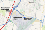
Warburton Green is a district of Hale Barns, Greater Manchester. It is situated to the south east of the centre of the village, close to the M56 and River Bollin. The housing estate grew up around the original hamlet, which was formed by Tanyard Farm and neighbouring properties on Chapel Lane. Warburton Green was originally in Ringway parish.
Excerpt from the Wikipedia article Warburton Green (License: CC BY-SA 3.0, Authors).Warburton Green
Ridge Avenue, Trafford
Geographical coordinates (GPS) Address Nearby Places Show on map
Geographical coordinates (GPS)
| Latitude | Longitude |
|---|---|
| N 53.36 ° | E -2.31 ° |
Address
Ridge Avenue
Ridge Avenue
WA15 0AY Trafford
England, United Kingdom
Open on Google Maps


