Canberra ( (listen) KAN-bər-ə; Ngunnawal: Ngambri)
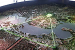
is the capital city of Australia. Founded following the federation of the colonies of Australia as the seat of government for the new nation, it is Australia's largest inland city and the eighth-largest Australian city overall. The city is located at the northern end of the Australian Capital Territory at the northern tip of the Australian Alps, the country's highest mountain range. As of June 2021, Canberra's estimated population was 453,558.The area chosen for the capital had been inhabited by Indigenous Australians for up to 21,000 years, with the principal group being the Ngunnawal people. European settlement commenced in the first half of the 19th century, as evidenced by surviving landmarks such as St John's Anglican Church and Blundells Cottage. On 1 January 1901, federation of the colonies of Australia was achieved. Following a long dispute over whether Sydney or Melbourne should be the national capital, a compromise was reached: the new capital would be built in New South Wales, so long as it was at least 100 mi (160 km) from Sydney. The capital city was founded and formally named as Canberra in 1913. A blueprint by American architects Walter Burley Griffin and Marion Mahony Griffin was selected after an international design contest, and construction commenced in 1913. Unusual among Australian cities, it is an entirely planned city. The Griffins' plan featured geometric motifs and was centred on axes aligned with significant topographical landmarks such as Black Mountain, Mount Ainslie, Capital Hill and City Hill. Canberra's mountainous location makes it the only mainland Australian city where snow-capped mountains can be seen in winter; although snow in the city itself is uncommon.
As the seat of the Government of Australia, Canberra is home to many important institutions of the federal government, national monuments and museums. This includes Parliament House, Government House, the High Court and the headquarters of numerous government agencies. It is the location of many social and cultural institutions of national significance such as the Australian War Memorial, the Australian National University, the Royal Australian Mint, the Australian Institute of Sport, the National Gallery, the National Museum and the National Library. The city is home to many important institutions of the Australian Defence Force including the Royal Military College Duntroon and the Australian Defence Force Academy. It hosts all foreign embassies in Australia as well as regional headquarters of many international organisations, not-for-profit groups, lobbying groups and professional associations.
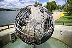
Canberra has been ranked among the world's best cities to live and visit. Although the Commonwealth Government remains the largest single employer in Canberra, it is no longer the majority employer. Other major industries have developed in the city, including in health care, professional services, education and training, retail, accommodation and food, and construction. Compared to the national averages, the unemployment rate is lower and the average income higher; tertiary education levels are higher, while the population is younger. At the 2016 Census, 32% of Canberra's inhabitants were reported as having been born overseas.Canberra's design is influenced by the garden city movement and incorporates significant areas of natural vegetation. Its design can be viewed from its highest point at the Telstra Tower and the summit of Mount Ainslie. Other notable features include the National Arboretum, born out of the 2003 Canberra bushfires, and Lake Burley Griffin, named for the city's architects. Highlights in the annual calendar of cultural events include Floriade, the largest flower festival in the Southern Hemisphere, the Enlighten Festival, Skyfire, the National Multicultural Festival and Summernats. Canberra's main sporting venues are Canberra Stadium and Manuka Oval. The city is served with domestic and international flights at Canberra Airport, while interstate train and coach services depart from Canberra Railway Station and the Jolimont Centre respectively. City Interchange is the main hub of Canberra's bus and light rail transport network.


