place

New Haven State Street station

2002 establishments in ConnecticutAmtrak stations in ConnecticutBuildings and structures in New Haven, ConnecticutMetro-North Railroad stations in ConnecticutRailroad stations in New Haven County, Connecticut
Railway stations in the United States opened in 2002Shore Line East stationsStations along New York, New Haven and Hartford Railroad linesStations on the New Haven–Springfield LineTransportation in New Haven, ConnecticutUse mdy dates from January 2023
New Haven State Street station, September 2018

New Haven State Street station is a commuter rail station located on State Street in downtown New Haven, Connecticut. The secondary railroad station in the city, it is located 0.8 miles (1.3 km) northeast of the much larger New Haven Union Station and is intended to offer easier access to New Haven's downtown business district. It is served by Shore Line East and Hartford Line commuter trains, Amtrak Hartford Line trains, Springfield-terminating Northeast Regional trains, and Valley Flyer trains, and a limited number of Metro-North Railroad New Haven Line trains. Originally proposed in 1996, State Street opened on June 7, 2002. A second platform opened on June 8, 2018, in time for the beginning of Hartford Line service.

Excerpt from the Wikipedia article New Haven State Street station (License: CC BY-SA 3.0, Authors, Images).

New Haven State Street station
Court Street, New Haven

Geographical coordinates (GPS) Address Nearby Places
placeShow on map

Wikipedia: New Haven State Street stationContinue reading on Wikipedia

Geographical coordinates (GPS)

Latitude Longitude
N 41.305763 ° E -72.921753 °
placeShow on map

Address

Court Street

Court Street
06511 New Haven
Connecticut, United States
mapOpen on Google Maps

New Haven State Street station, September 2018
Share experience

Nearby Places

Ninth Square Historic District

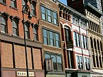
The Ninth Square Historic District encompasses a historically diverse and well-preserved part of the commercial area of Downtown New Haven, Connecticut. The district is bounded by Church, Court, State, and Crown Streets, and is centered on the intersection of Chapel and Orange Streets. The buildings in the district are mostly late-19th and early 20th commercial buildings, and includes a number of commercial buildings from the first half of the 19th century, a rarity in most of Connecticut's urban downtown areas. The district was listed on the National Register of Historic Places in 1984. Ninth Square takes its name from an early division of New Haven, when leaders of the New Haven Colony created a town plan of nine large squares in 1637, centered on the one now housing the New Haven Green. Because the ninth square was located closest to the colony's harbor, it was the first to develop a significant commercial presence. In the 1820s, the Farmington Canal was routed near the district, spurring further commercial development. The conversion of the canal right-of-way to railroad use intensified the area's commercial development in the second half of the 19th century. All of this resulted in a significant diversity of styles in the commercial buildings seen, generally reflecting architectural styles popular at the time of their construction. The area declined after World War II, but has been spared from destruction in urban renewal activities of the mid-20th century.The Ninth Square has been at the center of New Haven's cultural renaissance, densification and renewal over the last decade.