Galloway, Springfield, Missouri
Geography of Springfield, MissouriSouthwest Missouri geography stubs
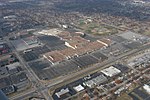
Galloway is a neighborhood of southeast Springfield, Missouri, United States. Galloway is located in a stream valley approximately one-half mile north of the U.S. Route 60 and U.S. Route 65 interchange and one mile south of Sequiota Park.
Excerpt from the Wikipedia article Galloway, Springfield, Missouri (License: CC BY-SA 3.0, Authors).Galloway, Springfield, Missouri
East Republic Road, Springfield
Geographical coordinates (GPS) Address Nearby Places Show on map
 Continue reading on Wikipedia
 Geographical coordinates (GPS)
| Latitude | Longitude |
|---|---|
| N 37.136666666667 ° | E -93.238055555556 ° |
Address
East Republic Road 2899
65804 Springfield
Missouri, United States
Open on Google Maps