Weed Patch Hill
Hills of IndianaLandforms of Brown County, IndianaSouthern Indiana geography stubs
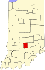
Weed Patch Hill, also known as Weed Patch Knob (1,058 feet or 322 m), is the third highest named summit in the U.S. state of Indiana. Located in Washington Township and Brown County State Park, it is the highest point in the Knobstone Escarpment. In Indiana, only Hoosier Hill (1,257 feet or 383 m) in Wayne County and Sand Hill (1,076 feet or 328 m) in Noble County are higher. Weed Patch Hill was so named by an early settler after a tornado had flattened a stand of trees and weeds grew in its place.
Excerpt from the Wikipedia article Weed Patch Hill (License: CC BY-SA 3.0, Authors).Weed Patch Hill
Upper Schooner Road,
Geographical coordinates (GPS) Address Nearby Places Show on map
Geographical coordinates (GPS)
| Latitude | Longitude |
|---|---|
| N 39.1669938 ° | E -86.2174898 ° |
Address
Upper Schooner Road
Upper Schooner Road
47448
Indiana, United States
Open on Google Maps


