Comerford Reservoir
Barnet, VermontLakes of Caledonia County, VermontLakes of Grafton County, New HampshireNew Hampshire geography stubsReservoirs in New Hampshire ... and 3 more
Reservoirs in VermontVermont geography stubsWaterford, Vermont

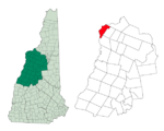
Comerford Reservoir is a 1,029-acre (4 km2) impoundment located on the Connecticut River on the boundary between Vermont and New Hampshire in the United States. The reservoir is formed by the Frank D. Comerford Dam in the towns of Monroe, New Hampshire, and Barnet, Vermont, and impounds water into the towns of Littleton, New Hampshire, and Waterford, Vermont, nearly to the Moore Reservoir upstream on the Connecticut.
Excerpt from the Wikipedia article Comerford Reservoir (License: CC BY-SA 3.0, Authors, Images).Comerford Reservoir
Comerford Dam Portage,
Geographical coordinates (GPS) Address Nearby Places Show on map
Geographical coordinates (GPS)
| Latitude | Longitude |
|---|---|
| N 44.325277777778 ° | E -72.000833333333 ° |
Address
Comerford Dam Portage
Comerford Dam Portage
New Hampshire, United States
Open on Google Maps


