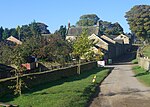
Whirlow

Whirlow is a suburb of the City of Sheffield in England, it lies 3.7 miles (6 km) south-west of the city centre. The suburb falls within the Dore and Totley ward of the City. It is one of the most affluent areas of Sheffield, with much high class housing and several notable small country houses within it. During the Victorian era it was home to some of Sheffield's most influential citizens. Whirlow straddles the A625 (Ecclesall Road South), the main Sheffield to Hathersage road. The suburb covers the area from Parkhead in the north to Whirlow Bridge in the south and from Ecclesall Woods in the east to Broad Elms Lane in the west. Whirlow had a population of 1,663 in 2011.
Excerpt from the Wikipedia article Whirlow (License: CC BY-SA 3.0, Authors, Images).Whirlow
Croft Lane, Sheffield Whirlow
Geographical coordinates (GPS) Address Nearby Places Show on map
Geographical coordinates (GPS)
| Latitude | Longitude |
|---|---|
| N 53.343 ° | E -1.527 ° |
Address
Croft Lane
Croft Lane
S11 9QG Sheffield, Whirlow
England, United Kingdom
Open on Google Maps


