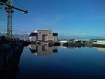
Walney Channel
Channels of EnglandDredged rivers and waterwaysGeography of Cumbria

The Walney Channel separates Walney Island from the British mainland. The northern portion of the channel opens into the Duddon Estuary and is both narrower and shallower. The southern half of the channel is wider and is regularly dredged to allow shipping to access the Port of Barrow. This half opens into Morecambe Bay. The channel is spanned by Walney Bridge (officially Jubilee Bridge) completed in 1908. Because of the needs of navigation, particularly the activities of the Vickers shipyard, it was constructed as a bascule bridge.
Excerpt from the Wikipedia article Walney Channel (License: CC BY-SA 3.0, Authors, Images).Walney Channel
Bridge Road,
Geographical coordinates (GPS) Address Nearby Places Show on map
Geographical coordinates (GPS)
| Latitude | Longitude |
|---|---|
| N 54.102 ° | E -3.24 ° |
Address
Shipyard
Bridge Road
LA14 1AF , Barrow Island
England, United Kingdom
Open on Google Maps


