place

Small's Pond

Geography of TorontoPonds of Toronto
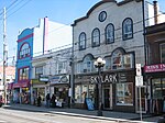
Houses overlooking Smalls Pond a

Smalls Pond was a pond located near Queen Street East and Kingston Road in Toronto, Canada. Some accounts say it was twelve feet deep, others that it was twelve meters deep. While some accounts say it was a natural feature, Jane Fairburn, in "Along the Shore: Rediscovering Toronto's Waterfront Heritage", wrote that gentleman farmer Charles Coxwell Small, owner of 472 acres (191 hectares), dammed a creek than called Serpentine Creek, to form the dam, for the water-power for sawmills.In late-19th-century winters its ice was harvested and stored, in slabs, as its waters remained clean, when the nearby Don River had become polluted. Stored slabs of ice were used to keep food cool before artificial refrigeration had been invented. The farmland surrounding the lake, and the small creeks that fed it, were annexed into the growing city of Toronto around the turn of the 20th century. By 1909 those creeks had become polluted, and were buried and converted into sewers. In 1919, a 9-year-old boy drowned in the pond.In 1935, after the creeks that fed it had been diverted, the pond had become stagnant, and was drained and filled in.

Excerpt from the Wikipedia article Small's Pond (License: CC BY-SA 3.0, Authors, Images).

Small's Pond
Penny Lane, Toronto

Geographical coordinates (GPS) Address Nearby Places
placeShow on map

Wikipedia: Small's PondContinue reading on Wikipedia

Geographical coordinates (GPS)

Latitude Longitude
N 43.66741 ° E -79.31294 °
placeShow on map

Address

Brett's

Penny Lane
M4L 6S5 Toronto
Ontario, Canada
mapOpen on Google Maps

Houses overlooking Smalls Pond a
Share experience

Nearby Places

Ashbridges Bay Wastewater Treatment Plant

The Ashbridges Bay Wastewater Treatment Plant is the city of Toronto's main sewage treatment facility, and the second largest such plant in Canada after Montreal's Jean-R. Marcotte facility. One of four plants that service the city of Toronto, it treats the wastewater produced by some 1.4 million of the city's residents and has a rated capacity of 818,000 (design capacity of 1,000,000) cubic metres per day. Until 1999 it was officially known as the Main Treatment Plant. The plant has a 185 m (607 ft) high smokestack which is visible from most parts of the city. The plant opened in 1910. Prior to this, Toronto's sewage flowed directly into Lake Ontario and a layer of thick sludge covered the lake to a distance of several hundred feet from shore. The lake was also the source of the city's drinking water and the pollution contributed to a major typhoid outbreak. The plant is located on the shore of Lake Ontario at the foot of Leslie Street at Ashbridge's Bay. To the west is the Port Lands area, a once heavily industrial area that is now mostly deserted. To the north is the Leslieville neighbourhood. When the plant was built, it was on the eastern edge of the city, far away from most residents. It is now surrounded by residential areas and strenuous efforts have been made to reduce odours and pollution. Most notable was the shuttering of the plant's incinerators in 1987. An odour control study was completed in 2002 and, beginning in 2002, the area around the plant was also redesigned into a large landscaped park. In 2005, a contract was awarded to design and construct a new odour control system.Until recently, all the sludge has been trucked off site. However, summer 2007 saw odour problems, with the Michigan landfill closed and the city removing only 6 of every 10 truckloads of sludge produced, leaving the rest in an aeration slough until autumn when agricultural applications for sludge resumed.