place

Hangingstone Hill

DartmoorHills of Devon
Hangingstone Hill summit

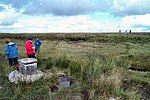
Hangingstone Hill is a hill in North Dartmoor in the southwest English county of Devon. At 603 metres high, it is the joint third highest peak in Devon and Dartmoor, together with Cut Hill, which lies around 4 kilometres to the southwest. The hill lies within the military training area on Dartmoor and is not accessible to the public except at certain times. There is a military road to the summit, which is marked by an Army observation post and flagpole. On clear days, the views are "superb", extending to Exmoor, the Quantocks, the River Teign estuary, and many of Dartmoor's peaks. The name of the hill is derived from a logan rock on the northwest hillside which no longer rocks, however. It was formerly known as Newtake Hill. Hangingstone is one of Dartmoor's thirteen Deweys and the tenth highest in England. About 600 metres almost due south is the summit of Whitehorse Hill which is a subpeak or twin peak of Hangingstone Hill. It has a drop of less than 10m.

Excerpt from the Wikipedia article Hangingstone Hill (License: CC BY-SA 3.0, Authors, Images).

Hangingstone Hill
Steeperton Tor Road, West Devon Dartmoor Forest

Geographical coordinates (GPS) Address Website Nearby Places
placeShow on map

Wikipedia: Hangingstone HillContinue reading on Wikipedia

Geographical coordinates (GPS)

Latitude Longitude
N 50.6586 ° E -3.9566 °
placeShow on map

Address

Range Warning Flagpole

Steeperton Tor Road
EX20 1QZ West Devon, Dartmoor Forest
England, United Kingdom
mapOpen on Google Maps

Website
webarchive.nationalarchives.gov.uk

linkVisit website

Hangingstone Hill summit
Share experience

Nearby Places

Gidleigh
Gidleigh

Gidleigh is a village and civil parish in the West Devon district of Devon, England. Located within Dartmoor National Park, the parish is surrounded clockwise from the north by the parishes of Throwleigh, Chagford and Dartmoor Forest. In 2001 its population was 116, little changed from 114 in 1901. Historically the parish consisted of a number of farmsteads and associated cottages scattered around the focal point of Holy Trinity church (late C15-early C16, with some C17 windows and C19 additions) and the adjacent Gidleigh Castle, which is now in private hands. The population peaked at 180 in the mid 19th century. The 20th century saw the development of some substantial gentleman's residences - notably Gidleigh Park, which subsequently became a country house hotel - and the building of a village hall. Gidleigh lies on the Mariners' Way and there was a YHA Youth Hostel in the village from 1932 to 1988. A Methodist elementary school established in 1877 at Providence in Throwleigh parish, little more than a mile from Gidleigh, provided what became the Throwleigh and Gidleigh County Primary School, which closed in 1971 when the pupils were transferred to Chagford. Gidleigh has a nearby public house in the Northmore Arms, a mile from the village at Wonson in Throwleigh parish, but has no village shop. Residents rely on nearby Chagford for shops and other services. Scorhill, one of the largest and best preserved stone circles in Devon, is near the village on Gidleigh Common. In fiction, Gidleigh is the setting for "The Mad Monk of Gidleigh" by Michael Jecks, which is set in 1323.