Mechell, Anglesey
Former wards of AngleseyGeographic coordinate listsLists of coordinatesMechell, Anglesey

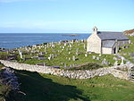
Mechell is a community in the north of the Isle of Anglesey, Wales. Llanfechell is the largest village within the community area. Tregele, Llanfflewyn, Mynydd Mechell, Bodewryd, Rhosbeirio and Carreglefn have a more dispersed settlement pattern. The antiquity of these settlements is shown by the presence of 6 medieval (or older) churches and some 16 more ancient sites dating back into prehistory. The population of the community in 2011 was 1,293.
Excerpt from the Wikipedia article Mechell, Anglesey (License: CC BY-SA 3.0, Authors, Images).Mechell, Anglesey
Brynddu Road,
Geographical coordinates (GPS) Address Nearby Places Show on map
Geographical coordinates (GPS)
| Latitude | Longitude |
|---|---|
| N 53.394 ° | E -4.45 ° |
Address
Brynddu Road
LL68 0PU , Mechell
Wales, United Kingdom
Open on Google Maps


