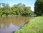
Killbuck Creek

Killbuck Creek is a tributary of the Walhonding River, 81.7 mi (131.5 km) long, in north-central Ohio in the United States. Via the Walhonding, Muskingum and Ohio Rivers, it is part of the watershed of the Mississippi River. It drains an area of 613 mi² (1588 km²).Killbuck Creek rises in northern Wayne County and initially flows in a counter-clockwise loop northward into southern Medina County and past the town of Burbank before turning to a southward course through Wayne, Holmes and Coshocton Counties to its mouth at the Walhonding River, 5 mi (8 km) west of the city of Coshocton. Along its course it flows to the west of the city of Wooster and passes the towns of Holmesville, Millersburg and Killbuck.A USGS stream gauge on the creek at Layland recorded a mean annual discharge of 502 cubic feet per second (14.2 m3/s) during water years 1924-1930. According to a US Environmental Protection Agency estimate, the mean annual discharge of the creek at its mouth is 625.34 cu ft/s (17.708 m3/s).
Excerpt from the Wikipedia article Killbuck Creek (License: CC BY-SA 3.0, Authors, Images).Killbuck Creek
Township Highway 28, Bethlehem Township
Geographical coordinates (GPS) Address Nearby Places Show on map
Geographical coordinates (GPS)
| Latitude | Longitude |
|---|---|
| N 40.329 ° | E -81.9393 ° |
Address
Township Highway 28
Township Highway 28
43812 Bethlehem Township
Ohio, United States
Open on Google Maps


