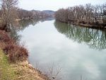
Muskingum River Navigation Historic District
Appalachian Ohio Registered Historic Place stubsBuildings and structures completed in 1816Canals in OhioHistoric Civil Engineering LandmarksHistoric districts on the National Register of Historic Places in Ohio ... and 5 more
National Register of Historic Places in Coshocton County, OhioNational Register of Historic Places in Morgan County, OhioNational Register of Historic Places in Muskingum County, OhioNational Register of Historic Places in Washington County, OhioUse mdy dates from August 2023

The Muskingum River Navigation Historic District is a 6,004 acres (24.30 km2) historic district in Ohio's Coshocton, Morgan, Muskingum, and Washington counties, which was listed on the National Register of Historic Places in 2007. The listing includes 12 contributing buildings, 32 contributing structures, and a contributing site.The "Muskingum River lock system was designated the first Navigation Historic District in the United States by the National Park Service." The Muskingum River Navigation System was also designated as a National Historic Civil Engineering Landmark by the American Society of Civil Engineers in 2001.It is traversed by the Muskingum River Water Trail.
Excerpt from the Wikipedia article Muskingum River Navigation Historic District (License: CC BY-SA 3.0, Authors, Images).Muskingum River Navigation Historic District
North Whitewoman Street,
Geographical coordinates (GPS) Address Nearby Places Show on map
Geographical coordinates (GPS)
| Latitude | Longitude |
|---|---|
| N 40.283888888889 ° | E -81.8775 ° |
Address
North Whitewoman Street
43812
Ohio, United States
Open on Google Maps


