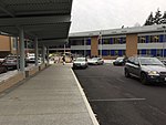
place

Lake Hills, Bellevue

King County, Washington geography stubsNeighborhoods in Bellevue, Washington
2018 Lake Hills sign

Lake Hills is a neighborhood in Bellevue, Washington. It lies to the south of the Crossroads and north of the Eastgate neighborhoods.In the early 1900s, Japanese immigrants farmed the part of Lake Hills between present day Larsen Lake and Phantom Lake. This agricultural activity was abruptly curtailed following the Japanese American Internment in 1942, and was eventually replaced by suburban housing. Lake Hills was annexed into Bellevue in 1969.Today the Lake Hills neighborhood contains Bellevue College, the Lake Hills Greenbelt Urban Demonstration Garden (also known as the Bellevue Demonstration Garden), and Larsen Lake.

Excerpt from the Wikipedia article Lake Hills, Bellevue (License: CC BY-SA 3.0, Authors, Images).

Lake Hills, Bellevue
Lake Hills Boulevard, Bellevue

Geographical coordinates (GPS) Address Phone number Website Nearby Places
placeShow on map

Wikipedia: Lake Hills, BellevueContinue reading on Wikipedia

Geographical coordinates (GPS)

Latitude Longitude
N 47.603333333333 ° E -122.13083333333 °
placeShow on map

Address

Lake Hills Library

Lake Hills Boulevard 15590
98007 Bellevue
Washington, United States
mapOpen on Google Maps

Phone number
King County Library System

call+14257473350

Website
kcls.org

linkVisit website

2018 Lake Hills sign
Share experience

Nearby Places

Bellevue Airfield

Bellevue Airfield (BVU) was a private airfield in the northwest United States, located in what is now the Eastgate Neighborhood of Bellevue, Washington, a suburb east of Seattle. It was situated east of 156th Avenue SE and north of Interstate 90 near Phantom Lake. The 2,300-foot (700 m) asphalt runway's elevation was at 345 feet (105 m) above sea level, and ran southwest to northeast (marked 2/20). Part of the airport's land was used as a landfill from 1951 till 1964, and featured a landfill gas venting system. Closed in 1983, today the area is an office park. When the LDS Seattle Washington Temple opened in 1980, the airfield was still in operation and the temple spire included a strobe light.Sometime after the airport closed, a new heliport was added at the north end of runway named Bellevue Business Park Boeing Company Services Headquarters Heliport with the designation of 71WA. It was reportedly used as a private heliport for the nearby Boeing Eastgate campus. The heliport was closed and the final visible remnants of the north end of the old runway were removed during construction of the Advanta Office Commons buildings leased by Microsoft. The disused heliport is still visible and is occasionally used as a basketball court. The remaining 27 acres north of the Advanta Office Commons was sold to City of Bellevue from Boeing who plans on developing it into Bellevue Airfield Park. However, design and construction is expected to take some time as renovation of the landfill gas system is required. Boeing sold the remainder of its Eastgate Office Park in 2021 and is expected to leave the campus entirely by 2023. The only remnants still visible is the heliport and the red and white lamp posts with two red strobe lights on top situated on the nearby overpasses to the south.