Yelachenahalli
Bangalore Urban district geography stubsGeography of BangaloreNeighbourhoods in BangaloreUse Indian English from March 2016
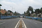
Yelachenahalli is a municipal area (halli means "village" in Kannada) on Kanakpura Road, Bangalore, but has fast developed into a hub of development with malls and high rise buildings. Over the last few years, this area has transformed itself into an extension to the IT city. It is very near to JP Nagara, approx 10 km from MG Road, 15 km from Electronic city. The village was called as Elajeeyaraha Halli in the 14th Century.
Excerpt from the Wikipedia article Yelachenahalli (License: CC BY-SA 3.0, Authors).Yelachenahalli
Bengaluru Konanakunte (Bommanahalli Zone)
Geographical coordinates (GPS) Address Nearby Places Show on map
 Continue reading on Wikipedia
 Geographical coordinates (GPS)
| Latitude | Longitude |
|---|---|
| N 12.895833333333 ° | E 77.579166666667 ° |
Address
560078 Bengaluru, Konanakunte (Bommanahalli Zone)
Karnataka, India
Open on Google Maps