Strohner Maarchen
Bogs of Rhineland-PalatinateMaars of the EifelNature reserves in Rhineland-PalatinateVulkaneifel

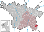
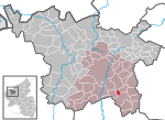
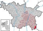
The Strohner Maarchen (also Strohner Märchen) is a dry maar near the village of Strohn in the Volcanic Eifel region of Germany. Its bowl forms an elongated oval and has a diameter of about 210 x 140 metres. Its name ("maarchen" means "little maar") stems from the fact that it is small for a maar. Together with the Pulvermaar to the north and the adjacent hill of Römerberg the Strohner Maarchen lies within the nature reserve of Pulvermaar mit Römerberg und Strohner Märchen.Vulcanologists from the Smithsonian Institution estimate the last eruption of the Strohner Maar and Pulvermaar in 8,300 BC.
Excerpt from the Wikipedia article Strohner Maarchen (License: CC BY-SA 3.0, Authors, Images).Strohner Maarchen
L 16, Daun
Geographical coordinates (GPS) Address Nearby Places Show on map
Geographical coordinates (GPS)
| Latitude | Longitude |
|---|---|
| N 50.122225 ° | E 6.928523 ° |
Address
L 16
54558 Daun
Rhineland-Palatinate, Germany
Open on Google Maps


