place

Brunnsviken

Geography of StockholmLakes of Stockholm CountyStockholm County geography stubs
Brunnsviken
Brunnsviken

Brunnsviken (literally The Bay of Wells) is a 3.5 kilometres (2.2 mi) by 0.4–0.5 kilometres (0.25–0.31 mi) brackish lake in Sweden located on the boundary between Solna Municipality and Stockholm Municipality, connecting to Lilla Värtan through Ålkistan. It has a perimeter of 12 kilometres (7.5 mi). Around Brunnsviken there are a wide range of interesting buildings and facilities. Brunnsviken stretches all the way from Vasastaden, Stockholm in the south to Bergshamra, Solna in the north, with Hagaparken along the western shoreline. In the 1700s, Gustav III had plans to build a continuous belt of English parks around the lake. Since 1994, Brunnsviken has been a part of the Royal National City Park.

Excerpt from the Wikipedia article Brunnsviken (License: CC BY-SA 3.0, Authors, Images).

Brunnsviken
Tivoli brygga, Solna kommun

Geographical coordinates (GPS) Address Nearby Places
placeShow on map

Wikipedia: BrunnsvikenContinue reading on Wikipedia

Geographical coordinates (GPS)

Latitude Longitude
N 59.37 ° E 18.038333333333 °
placeShow on map

Address

HBK

Tivoli brygga
170 74 Solna kommun
Sweden
mapOpen on Google Maps

Brunnsviken
Brunnsviken
Share experience

Nearby Places

Haga trädgård

Haga Trädgård is a garden located at the northern end of Haga Park in Solna, Sweden. Haga Trädgård was founded by King Gustav III in the 1785. It was intended that it should become the kitchen garden to the royal household. At the time Gustav III had plans to build a very large palace just 300m from Haga Trädgård but eventually due to lack of available finance the palace was never built. The Haga Tradgard gardens were indeed established and provided the royal household with many different local and exotic vegetables and fruits. In 1812 the King purchased 20 figs from the gardens at a cost of 2 kronor each. At the time a garden employee earned just 7.5 öre per hour. The gardens flourished and became a well known source for flowers and vegetables. In 1917 the department store NK took over the gardens to grow fresh vegetables for Stockholm's inhabitants. It was at the tail end of the first World War and fresh vegetables were quite scarce. In 1917, NK built a splendid conservatory which now is Stockholms oldest conservatory. In 1933 the town council of Stockholm took over the gardens and produced flowers for official use and for embellishment of squares and gardens. In 1989 Stephen and Marie Fried opened the Fjärilshuset ("Butterfly House") in Haga Gardens which once again turned the area into a visitor attraction. The butterfly house was so successful that Stephen and Marie Fried bought all of the buildings from the town council with the Royal Swedish Land Agency retaining the land. Nowadays Fjärilshuset is a national museum with the buildings being held privately and the land leased by Fjarilshuset Haga Tradgard AB. Haga Tradgard is successively being restored so that it mirrors its historical continuity.

Ålkistan
Ålkistan

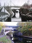
Ålkistan (Swedish: "The Eel Hatch") is the name of a canal, and the surrounding area, north of Stockholm, Sweden. The canal connects Lilla Värtan to Lake Brunnsviken, and delimits Bergshamra, the northern part of Solna, from the northern part of Djurgården. The name Ålkistan first appears on a map of Djurgården dated 1649, pointing out Åhlekijstetorpet ("The Eel Hatch Cottage"), Åhlekijstebackan ("The Eel Hatch Hillside") and Åhlekijste wijken ("The Eel Hatch Bay"). In a rivulet leading to the bay eels were caught using cages (in Swedish called kista, "coffin"), which gave the area its present name. The cottage is mentioned as a tavern in 1789.By the mid-19th century, mud threatened to cork the rivulet, which would effectively have turned Lake Brunnsviken, being used as refuse dump as it was, into a sewer. King Charles XV therefore ordered the present canal to be constructed in 1863, which lowered the water level of Brunnsviken by two metres. A 6.5-metre-wide (21 ft) wooden bridge with a mobile flap leading over the canal was added at the same time. The bridge was substituted in 1937 by a 23-metre-wide (75 ft) bridge with an 18-metre-wide (59 ft) roadway and a horizontal clearance of 8 metres, rebuilt in 1972.There was a railway stop at Ålkistan from 1885 until 1923, at the Roslag Railway. The railway is still operational, but the trains do not stop at Ålkistan anymore. As of 2007, no ships wider than 4.0 metres or deeper than 1.6 metres are allowed in the canal. Next to Ålkistan is a residential area, Sfären ("The Sphere"), with a local centre.