place

Thorpe, Derbyshire

Civil parishes in DerbyshireDerbyshire DalesDerbyshire geography stubsEngvarB from May 2020Towns and villages of the Peak District
Villages in Derbyshire
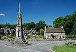
Fields by Ilam Church and Thorpe Cloud geograph.org.uk 24525

Thorpe is a village and civil parish in the English county of Derbyshire; it is on the Derbyshire/Staffordshire border, on the east bank of the River Dove, about four miles north of Ashbourne. The population of the civil parish as at the 2011 census was 183.Thorpe is at the southern end of the Peak District National Park almost at the foot of Thorpe Cloud, and is used by some visitors as a base for exploring Dovedale and the Manifold Valley. The Limestone Way long-distance bridleway passes through Thorpe, as does the Peak District Boundary Walk.The Dovedale Dash, a 4¾ mile cross-country running race held annually each November, was first organised here in 1953. It formerly had a railway station, Thorpe Cloud railway station, served by the LNWR Ashbourne to Buxton branch line, which linked with the Cromford and High Peak Railway at Parsley Hay. This former trackbed now forms the long distance Tissington Trail cycle and footpath trail.

Excerpt from the Wikipedia article Thorpe, Derbyshire (License: CC BY-SA 3.0, Authors, Images).

Thorpe, Derbyshire
Hall Lane, Derbyshire Dales

Geographical coordinates (GPS) Address Nearby Places
placeShow on map

Wikipedia: Thorpe, DerbyshireContinue reading on Wikipedia

Geographical coordinates (GPS)

Latitude Longitude
N 53.05 ° E -1.768 °
placeShow on map

Address

Hall Lane

Hall Lane
DE6 2AW Derbyshire Dales
England, United Kingdom
mapOpen on Google Maps

Fields by Ilam Church and Thorpe Cloud geograph.org.uk 24525
Share experience

Nearby Places

Okeover Hall
Okeover Hall

Okeover Hall is a privately owned Grade II* listed country house in Okeover, Staffordshire, England. It is the family seat of the Okeover family, who have been in residence since the reign of William Rufus. The house lies close to the border between Staffordshire and Derbyshire, which lies on the far side of the small River Dove. The Hall is not open to the public. The house and manor church (14th century, restored by Sir George Gilbert Scott) were pillaged by the Jacobite forces as they marched south to Swarkstone Bridge in 1745. In 1745–47, Leak Okeover had the old hall enlarged to Palladian designs by a London carpenter and joiner, Joseph Sanderson, a cousin of John Sanderson, the architect. The house is a testament to the high level of education and competence that might be elicited from a well-trained Georgian craftsman. The Georgian east wing is the oldest part of the house dating from 1745 to 1746. A north wing was demolished in the early 19th century. The south and west wings were rebuilt 1953–60 to a sensitive Neo-Georgian design by Marshall Sisson. Stables at right angles to the house form a separate nine-bay range with a central pediment on Doric pilasters over three rusticated arches and are separately listed as Grade II. A feature of the house is the Grade II* wrought iron inner gateway (1756) with armorial overthrow, by master smith Benjamin Yates, a pupil of Robert Bakewell, and the outer gates, also Grade II*, by Bakewell himself. In 1887, the Hon. Maud Okeover married Sir Andrew Barclay Walker, a successful brewer of Gateacre, Liverpool (see Walker-Okeover baronets), who in 1884 had purchased Osmaston Manor in nearby Derbyshire. His son, Sir Peter Walker, the 2nd Baronet, married Ethel Okeover in 1899. Sir Ian Walker, the 3rd Baronet, inherited Okeover in 1956 and assumed the name of Walker-Okeover, demolished Osmaston Manor in 1964, and moved the family seat back to Okeover. The estate is currently owned by Sir Andrew Walker-Okeover, 5th Baronet. Several members of the family have served as High Sheriff of Staffordshire and of Derbyshire.