Harrl
Hill ranges of Lower SaxonyNatural regions of the Weser-Leine UplandsSchaumburg

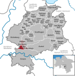
The Harrl is a high, wooded western outlier of the Bückeberg hill ridge in the Weser Uplands of central Germany. It is up to 213 m above sea level (NN) and lies in the Lower Saxon county of Schaumburg.
Excerpt from the Wikipedia article Harrl (License: CC BY-SA 3.0, Authors, Images).Harrl
Trail,
Geographical coordinates (GPS) Address Nearby Places Show on map
Geographical coordinates (GPS)
| Latitude | Longitude |
|---|---|
| N 52.246666666667 ° | E 9.0783333333333 ° |
Address
Idaturm
Trail
31675 , Bergdorf
Lower Saxony, Germany
Open on Google Maps


