Ulmener Maar
Cochem-ZellFirst 100 IUGS Geological Heritage SitesLakes of Rhineland-PalatinateMaars of the Eifel

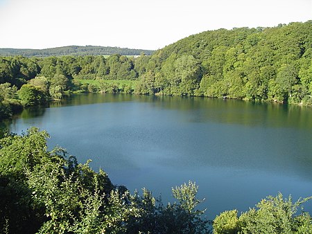
The Ulmener Maar is a maar in the Eifel mountains of Germany in the immediate vicinity of the town of Ulmen in the state of Rhineland-Palatinate. The lake is up to 37 metres deep and is surrounded by an embankment of tuff with an average height of 20 metres, which was formed from the erupted material of the former volcano. By the southern edge of the embankment are the ruins of a knight's castle, Ulmen Castle dating to the 11th century.
Excerpt from the Wikipedia article Ulmener Maar (License: CC BY-SA 3.0, Authors, Images).Ulmener Maar
Am Maar, Ulmen
Geographical coordinates (GPS) Address Nearby Places Show on map
Geographical coordinates (GPS)
| Latitude | Longitude |
|---|---|
| N 50.21 ° | E 6.98306 ° |
Address
Ulmener Maar
Am Maar
56766 Ulmen
Rhineland-Palatinate, Germany
Open on Google Maps


