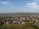
Lohfelderfähre
Bad HonnefCologne region geography stubs

Lohfelderfähre is a district of Bad Honnef, Germany. It evolved around the Eastern bank pier of the car ferry across the Rhine between Bad Honnef and Rolandseck.
Excerpt from the Wikipedia article Lohfelderfähre (License: CC BY-SA 3.0, Authors, Images).Lohfelderfähre
Rheinstraße,
Geographical coordinates (GPS) Address Nearby Places Show on map
Geographical coordinates (GPS)
| Latitude | Longitude |
|---|---|
| N 50.631858333333 ° | E 7.2141666666667 ° |
Address
Rheinstraße
Rheinstraße
53604 , Selhof
North Rhine-Westphalia, Germany
Open on Google Maps


