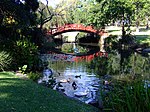
City of Wollongong
1859 establishments in AustraliaAccuracy disputes from March 2022City of WollongongLocal government areas of New South WalesUse Australian English from October 2012 ... and 1 more
Wollongong

The City of Wollongong is a local government area in the Illawarra region of New South Wales, Australia. The area is situated adjacent to the Tasman Sea, the Princes Motorway and the Illawarra railway line. Located 80 kilometres (50 mi) south of Sydney, the City of Wollongong covers 714 square kilometres (276 sq mi) and occupies a narrow coastal strip bordered by the Royal National Park to the north, Lake Illawarra to the south, the Tasman Sea to the east and the Illawarra escarpment to the west. The Lord Mayor of the City of Wollongong Council is Councillor Gordon Bradbery, an independent politician.
Excerpt from the Wikipedia article City of Wollongong (License: CC BY-SA 3.0, Authors, Images).City of Wollongong
Vickery Street, Wollongong City Council Gwynneville
Geographical coordinates (GPS) Address Nearby Places Show on map
Geographical coordinates (GPS)
| Latitude | Longitude |
|---|---|
| N -34.416666666667 ° | E 150.88333333333 ° |
Address
Vickery Street
2500 Wollongong City Council, Gwynneville
New South Wales, Australia
Open on Google Maps


