Sweetwater River (California)

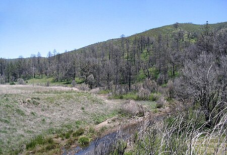
The Sweetwater River is a 55-mile (89 km) long stream in San Diego County, California. From its headwaters high in the Cuyamaca Mountains, the river flows generally southwest, first through rugged hinterlands but then into the urban areas surrounding its mouth at San Diego Bay. Its drainage basin covers more than 230 square miles (600 km2), all of it within San Diego County. Towns on the river include Descanso, La Presa and Chula Vista. The term "Sweetwater" is a name often given to freshwater which tastes good in regions where much of the water is bitter to the taste. The Spanish called the river "Agua Dulce", a name they applied to good clear water anywhere they lived.
Excerpt from the Wikipedia article Sweetwater River (California) (License: CC BY-SA 3.0, Authors, Images).Sweetwater River (California)
Gunpowder Point Drive, Chula Vista
Geographical coordinates (GPS) Address Nearby Places Show on map
Geographical coordinates (GPS)
| Latitude | Longitude |
|---|---|
| N 32.642777777778 ° | E -117.11472222222 ° |
Address
U.S. Fish & Wildlife
Gunpowder Point Drive
91950 Chula Vista
California, United States
Open on Google Maps


