place

White Peak Estate

National Trust properties in DerbyshireNational Trust properties in StaffordshirePeak DistrictUse British English from February 2024

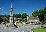
The White Peak Estate (previously known as the South Peak Estate) of the National Trust comprises several land holdings in the Southern Peak District, now referred to as Ilam Park, Dovedale and the White Peak in National Trust publications although administered from the "White Peak Estate Office". The holdings, totaling some 3,600 acres (1,500 ha), are managed from the estate office in Ilam and comprise: Ilam Park, including Ilam Hall which is let to the Youth Hostel Association (YHA) Dovedale from Thorpe Cloud to Wolfscote Dale and Biggin Dale Wetton Hill and Wetton Mill Ossam's Hill Hamps Valley Woodlands (and Beeston Tor) Grindon Moor Ecton Land at Monyash Alsop Moor Stanton Moor Edge Ravenstor YHA Taddington Wood High Weeldon Winster Market House (the National Trust's first property in the Peak District, 1906)Dovedale itself was acquired in 1934, and a string of acquisitions followed until 1938; Wolfscote Dale was acquired in 1948.

Excerpt from the Wikipedia article White Peak Estate (License: CC BY-SA 3.0, Authors).

White Peak Estate
The Oaks, Staffordshire Moorlands Ilam

Geographical coordinates (GPS) Address Nearby Places
placeShow on map

Wikipedia: White Peak EstateContinue reading on Wikipedia

Geographical coordinates (GPS)

Latitude Longitude
N 53.055 ° E -1.807 °
placeShow on map

Address

Ilam Hall overflow car park

The Oaks
DE6 2AZ Staffordshire Moorlands, Ilam
England, United Kingdom
mapOpen on Google Maps

Share experience

Nearby Places

Blore
Blore

Blore (grid reference SK137493) is a small village and parish in the Staffordshire Moorlands District of England. It is on an acclivity above Dovedale, three and a half miles north west of Ashbourne, including the hamlet of Swinscoe, one mile (1.6 km) to the south and a part of the parochial chapelry of Calton. The ecclesiastical parish is Blore Ray with Okeover and the civil parish is Blore-with-Swinscoe, both with slightly different boundaries. Blore parish, exclusive of the portion of Calton, contains about 2,000 acres (8.1 km2) and 273 souls. Swinscoe contains about 1,000 acres (4.0 km2). The village of Blore comprises Blore Hall (now owned by the Holiday Property Bond), St Bartholomew's parish church, the Old Rectory, a few other houses and several farms. The hall was first mentioned in 1331, though only one building remains substantially unaltered since 1661. The Holiday Property Bond is a life assurance bond investment in securities and assets. Its 35,000 Bondholders have exclusive access to Blore Hall. Blore Hall was the home of the Bassett family, (from whom the Queen is descended) ; William Bassett, the last of the male line, died in 1601 and his magnificent alabaster tomb, erected by his wife about 1630, can be seen in the church. Blore Church was built around 1100 and is a Grade 1 listed building. Apart from the Bassett tomb, it has remained virtually unchanged for almost 400 years. It was extensively restored between 1994 and 1997.

Long Low, Wetton

Long Low is a Neolithic and Bronze Age site in the English county of Staffordshire. It is about 2 km SE of Wetton (grid reference SK122539).It consists of two round cairns linked by a connecting bank – an unusual layout and one that is unique in England. The northern cairn measures 23 metres (75 ft) in diameter and survives to a height of 2.4 metres (7 ft 10 in). It appears to be related to other chamber tombs of the Peak District group and was excavated by Samuel Carrington in 1849. Carrington found a burial chamber built from limestone orthostats with a paved floor. The bones of thirteen individuals were recovered as well as three leaf-shaped flint arrowheads. The smaller southern cairn is 15 metres (49 ft) across and survives to 1.2 metres (3 ft 11 in) in height following extensive modern damage. It contained evidence of a cremation burial. Further cremations were found in the connecting bank which was built from a parallel row of limestone orthostats and is around 200 metres (660 ft) long, 10 metres (33 ft) wide and 2 metres (6 ft 7 in) high. It is now topped by a modern dry stone wall. Because of the damage to the site, its rarity and the antiquity of the Carrington excavation it is unclear as to the precise nature of the monument. It is possible that the bank is a bank barrow which had a later Neolithic chambered cairn (the north cairn) built on one end and then a Bronze Age round barrow finally added at the southern end.