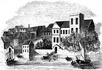
Temple Bar, London

Temple Bar was the principal ceremonial entrance to the City of London from the City of Westminster. In the middle ages, London expanded city jurisdiction beyond its walls to gates, called ‘bars’, which were erected across thoroughfares. To the west of the City of London, the bar was located in the area known as the Temple. Temple Bar is situated on the historic royal ceremonial route from the Tower of London to the Palace of Westminster, the two chief residences of the medieval English monarchs, and from the Palace of Westminster to St Paul's Cathedral. The road east of Temple Bar and within the City is Fleet Street, while the road to the west, in Westminster, is The Strand. At Temple Bar, the Corporation of the City of London formerly erected a barrier to regulate trade into the City. The 19th century Royal Courts of Justice are located next to it on its north side, having been moved from Westminster Hall. To its south is the Temple Church, along with the Inner Temple and Middle Temple Inns of Court. As the most important entrance to the City of London from Westminster, it was formerly long the custom for the monarch to halt at Temple Bar before entering the City of London, in order for the Lord Mayor to offer the Corporation's pearl-encrusted Sword of State as a token of loyalty. The term 'Temple Bar' strictly refers to a notional bar or barrier across the route, but it is also commonly used to refer to the 17th-century ornamental Baroque arched gateway designed by Christopher Wren, which spanned the road until its removal in 1878. A memorial pedestal topped by a dragon symbol of London, and containing an image of Queen Victoria, was erected to mark the bar's location in 1880. Wren's arch was preserved and was re-erected in 2004 in the City, in Paternoster Square next to St Paul's Cathedral.
Excerpt from the Wikipedia article Temple Bar, London (License: CC BY-SA 3.0, Authors, Images).Temple Bar, London
Fleet Street, London Holborn
Geographical coordinates (GPS) Address Nearby Places Show on map
Geographical coordinates (GPS)
| Latitude | Longitude |
|---|---|
| N 51.513611111111 ° | E -0.11194444444444 ° |
Address
RBS
Fleet Street 1
EC4Y 1BD London, Holborn
England, United Kingdom
Open on Google Maps


